dataset
Type of resources
Available actions
IADC Research Activities
Topics
Keywords
Contact for the resource
Provided by
Years
Formats
Representation types
Update frequencies
status
Scale
-
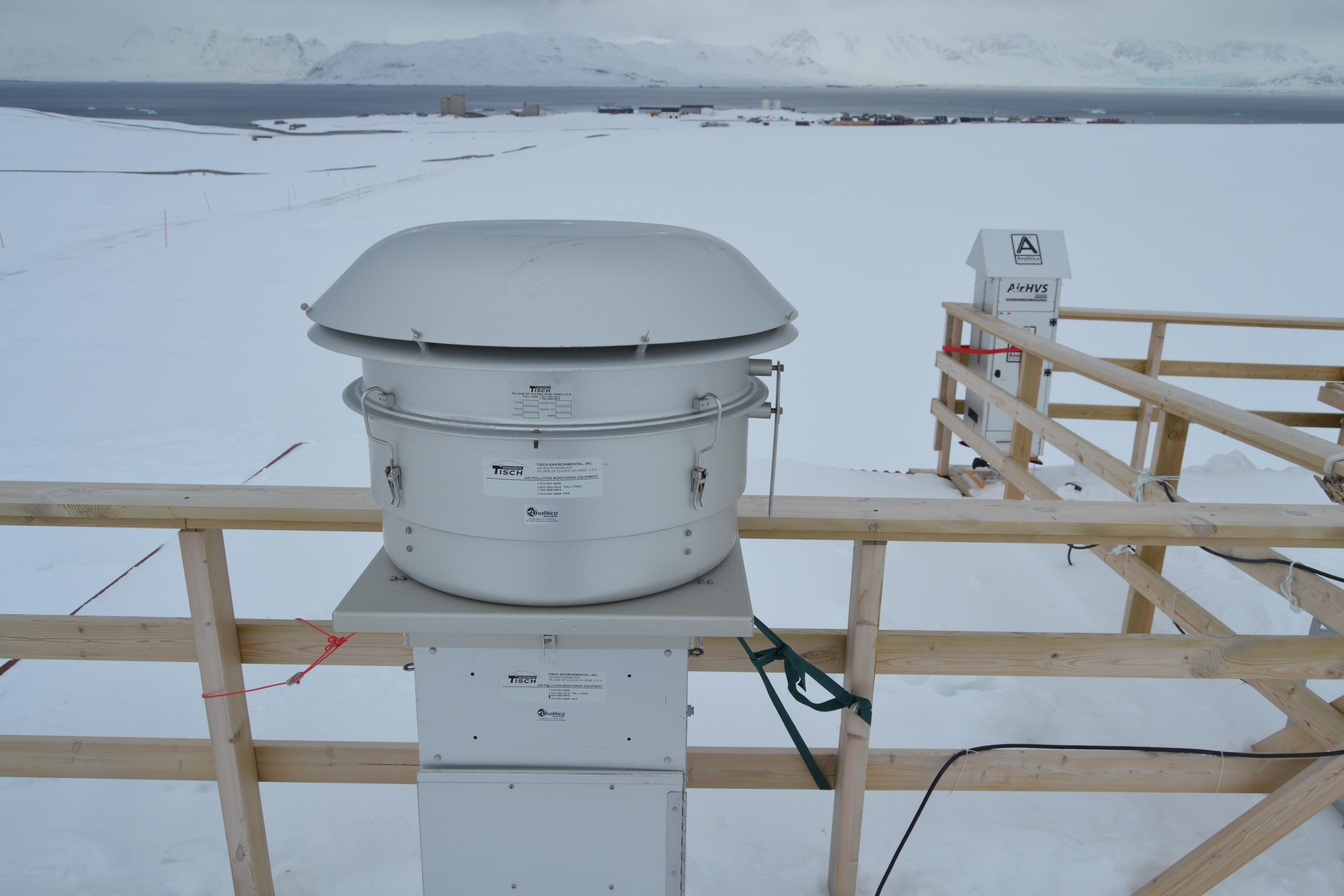
Sampling of PM10 aerosol using a cascade impactor to define the chemical composition in six different size stages. The quartz filters were extracted with ultrapure water and water soluble species were determined: major ions, MSA, carboxylic acids, amino acids, sugars, phenolic compounds, and other organic water-soluble emergening pollutants.
-
Brief narrative summary of the content of the resource(s)
-

Measurements are obtained using a Pyrgeometer Kipp&Zonen, model CGR4, installed at Thule Air Base (220 m a.s.l.) in May 2013. The instrument sensitivity was determined during factory calibration for temperatures down to -40 °C, thus specifically suited for the polar environment. Data are acquired by a datalogger at 30 s time intervals and then transferred to a PC. The CGR4 and its dedicated PC are maintained by Daniela Meloni at ENEA.
-
Snow sampling every week near Gruvebadet (Svalbard)
-

2022 NAIS at Gruvebadet
-

This dataset compiles measurements of gas exchange and associated microclimatic conditions for two dominant dwarf shrub species (Dryas octopetala and Salix polaris) and bare soil control plots. It is important to note that the presented data do not derive from continuous monitoring (e.g., Eddy Covariance) but consist of point (instantaneous) measurements conducted manually during the peak of the summer growing season (July) between 2021 and 2024.
-

This dataset comprises measurements from moored multiparametric probe, collected by the Aldo Pontremoli Mooring (MAP), which is managed by the Institute of Polar Sciences of the National Research Council (CNR). The Aldo Pontremoli Mooring (MAP), operated by the Institute of Polar Sciences of the National Research Council (CNR), has been active in the Kongsfjord, located in the Svalbard archipelago, since September, 2020. The instrument collect a wide array of physical and biogeochemical Essential Ocean Variables, including velocity and direction of currents. This activity is part of the Svalbard Integrated Arctic Earth Observing System (SIOS), which aims to monitor the impacts of climate change, such as the rapid loss of sea ice cover, the retreat of local glaciers, and the Atlantification of Arctic seas. Time series acquisition is ongoing and will continue, supported by funding from JRA ENI-CNR. The project's goal is to analyse the environmental feeback related to the material released into the marine environment due to permafrost melting. Reactivated permafrost can have significant consequences for both climate and the environment by contributing to the release of greenhouse gases into the atmosphere and pollutants into aquatic ecosystems
-
This proposal will focus, by means of a multidisciplinary and well-balanced consortium on eutrophication, contaminants, marine litter and underwater noise descriptors of the MSFD. vertical acquisition in 18 CTD station in Kongsfjorden with water sampling at 2-3 depths (surface, intermediate, bottom)for nutrient and pH analyses of sampled water in the lab. parameters: Pressure, Strain Gauge [db]rnTemperature [IPTS-68, deg C]rnConductivity [mS/cm]rnpHrnOxygen, SBE 43 [ml/l]rnTurbidity, Turner Cyclops [NTU] Pressure, Strain Gauge [db]rnTemperature [IPTS-68, deg C]rnConductivity [mS/cm]rnpHrnOxygen, SBE 43 [ml/l]rnTurbidity, Turner Cyclops [NTU]
-
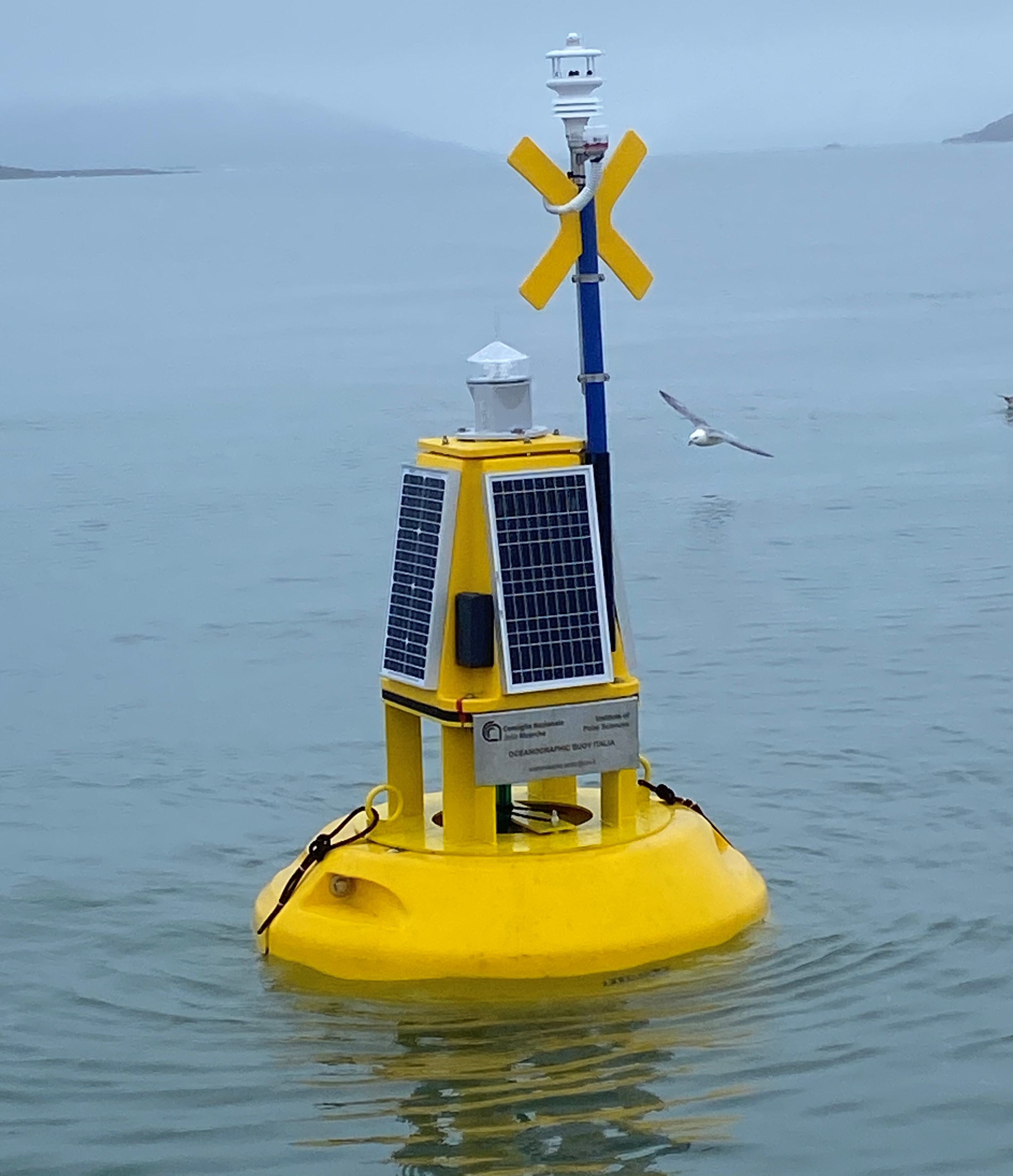
This dataset comprises measurements from moored surface buoy installed in the Kongsfjorden in proximity of the Mooring Dirigibile Italia (MDI). The buoy is managed by the Institute of Polar Sciences of the National Research Council (CNR). The buoy was moored in September 2023 with the aim to expand the observation on the sea-surface layer and also on the athmosphere in the framework of the Italian PNRR project ITINERIS. The buoy is equipped with sea surface temperature sensor positioned at 1m below the sea-level and meteorological station mounted at 2 m above the sea-leve. Mesured properties are seawater temperature, wind speed and direction, air pressure, air temperature, solar radiation and atmospheric humidity.
-
DOC fractionation: dynamic of POPs and trace metals Arctic DOC (ArcticDOC) The sampling design is projected to cover almost five sampling points in the Kongsfjorden. The sampling of surface water (approximately 100 liters for each sampling point) and sediment are aimed at the determination of persistent and emerging contaminants: POPs PFAS, CUPs, PPCPs, endocrine disruptors such as nonylphenols and bisphenol A. At the same time, with tangential-flow ultrafiltration, dissolved organic matter (DOM) will be characterized according to size fractions (colloidal and truly dissolved) and the distribution of contaminants associated to these fractions will be evaluated.