ITALY
Type of resources
Available actions
IADC Research Activities
Topics
Keywords
Contact for the resource
Provided by
Years
Formats
Representation types
Update frequencies
status
Scale
-
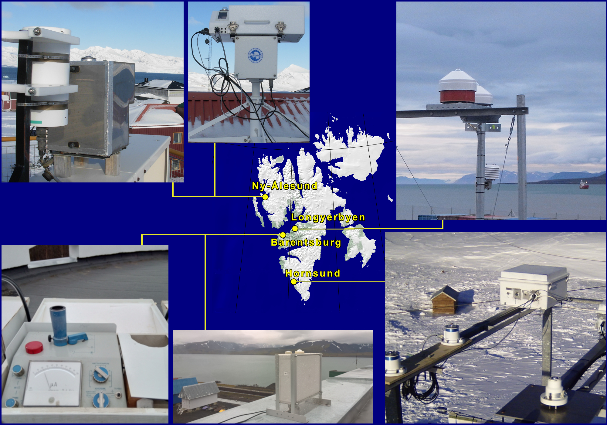
Ultraviolet Irradiance Variability in the Arctic U-VIVA Dataset contains results of the observed at 4 Svalbard stations ozone depletion episode that took place in the spring 2020 and its effect on the ultraviolet solar radiation reaching the ground. The ozone column was registered by Brewer #050 spectroradiometer, GUV and UV-RAD filter radiometers all operating in Ny-Ålesund, and by M-124 ozonometer working in Barentsburg. The solar radiation in UV-B, UV-A and erythemal UVE spectral bands that are impacted by the ozone column was measured by GUV and UV-RAD radiometers at Ny-Ålesund and, by UVS-E-T and UVS-AE-T Kipp & Zonen radiometers operating in Longyearbyen and Hornsund, respectively. An analysis of the data is presented in the 2021 SESS report published by Svalbard Integrated Arctic Earth Observing System (SIOS).
-

Homogenized Tethered Balloon record at station Ny-Ålesund, Spitsbergen in 2018 The scientific goals of BC-3D are to evaluate the distribution of Black Carbon and Mineral Dust in the first layers of atmosphere and surface snow over targeted Svalbard glaciers in order to identify the mechanisms of the air/snow exchanges also assisted by model predictions to provide the full 3D picture. Aerosol vertical profiles by tethered balloon: Aerosol vertical profiles gridded at a 50 m spatial resolution: R, T, P, RH, Aerosol size distribution, BC concentration. Maximum altitudes 1500 m.
-
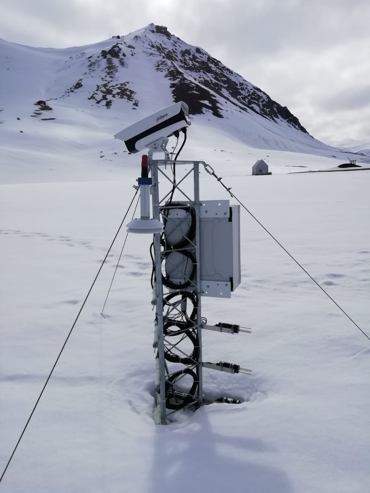
The automated nivological station was installed in November 2020 in a flat area over the tundra about 80 meters far from the Gruvebadet Atmospheric Laboratory and nearby a snow sampling site from where weekly snow samples are collected for chemical analysis. Sensors (Pt100 1/3 DIN) have been calibrated by their companies before installation and are connected to a datalogger for continuous acquisition. For all the parameters, data are logged with 10-minute time resolution and then averaged over 1 hour. This activity is carried out by the Aldo Pontremoli Centre part of the Joint Research Agreement ENI-CNR, in the framework of the SnowCorD project (SIOS Core Data).
-

Ice Nuclei Particle Concentration (INPAIR) INPAIR Svalbard' Chemistry and Physics of the Atmosphere: Ice nucleating particle (INPs) concentration obtained in spring and summer campaigns in the Arctic Region. Measurements of INPs concentrations and activation fraction of aerosol in Arctic (e.g. Gruvebadet observatory in Ny-Ãlesund). b) Correlating INPs concentration with meteorological parameters and physicochemical characterisations. Instrument: PM1 and PM10 sampling lines. DFPC chamber
-

Chronobiology of polar organisms (Chronopolar) Monitoring water parameters in surface and deep (3.0 meters) using DS18B20 + rasberry-pi. Sample collection: Lepidurus arcticus.
-
Isotopic characterisation of arcic ponds Sampling of ponds and surrouding terrestrial envionrment. matter (expressed as ash fry dry matter) and N content as a percentage in soil and lake sediment.
-

The automated nivological station was installed in November 2020 in a flat area over the tundra about 80 meters far from the Gruvebadet Atmospheric Laboratory and nearby a snow sampling site from where weekly snow samples are collected for chemical analysis. Sensors have been calibrated by their companies before installation and are connected to a datalogger for continuous acquisition. For all the parameters, data are logged with 10-minute time resolution and then averaged over 1 hour. This activity is carried out by the Aldo Pontremoli Centre part of the Joint Research Agreement ENI-CNR.
-
Snow sampling every year at the Kongsvegen glacier, in Svalbard
-
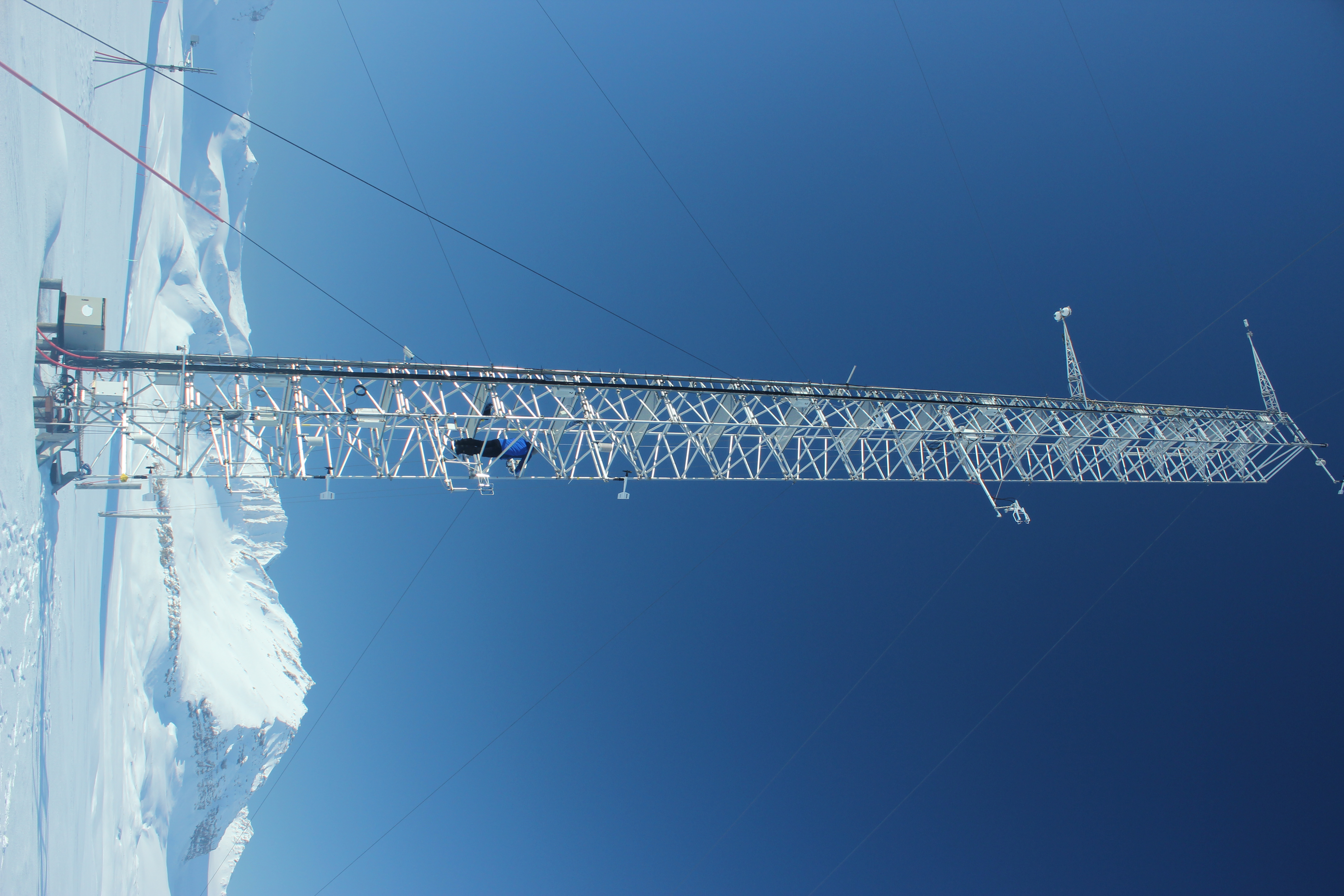
The automated station to measures snow cover is operating at the Amundsen-Nobile Climate Change Tower since 2010, which is in a tundra site almost flat, located in the Kolhaugen area. The station is part of a complex infrastructure where multi-disciplinary observations are routinely performed. Data were collected using an ultrasonic distance sensor. This activity is carried out in the framework of the SnowCorD project (SIOS Core Data).
-
Snow sampling every week near Gruvebadet (Svalbard)