Type of resources
Available actions
IADC Research Activities
Topics
Keywords
Contact for the resource
Provided by
Years
Formats
Representation types
Update frequencies
status
Scale
-
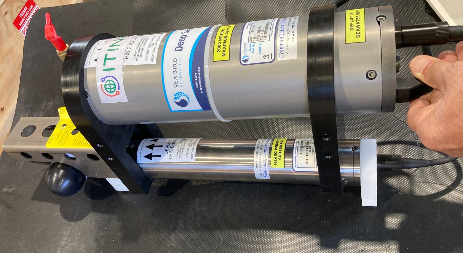
This dataset comprises measurements from moored multiparametric probe, collected by the Aldo Pontremoli Mooring (MAP), which is managed by the Institute of Polar Sciences of the National Research Council (CNR). The Aldo Pontremoli Mooring (MAP), operated by the Institute of Polar Sciences of the National Research Council (CNR), has been active in the Kongsfjord, located in the Svalbard archipelago, since September, 2020. The instrument collect a wide array of physical and biogeochemical Essential Ocean Variables, including seawater pressure, temperature, conductivity, salinity, dissolved oxygen concentration and pH. This activity is part of the Svalbard Integrated Arctic Earth Observing System (SIOS), which aims to monitor the impacts of climate change, such as the rapid loss of sea ice cover, the retreat of local glaciers, and the Atlantification of Arctic seas. Time series acquisition is ongoing and will continue, supported by funding from JRA ENI-CNR. The project's goal is to analyse the environmental feeback related to the material released into the marine environment due to permafrost melting. Reactivated permafrost can have significant consequences for both climate and the environment by contributing to the release of greenhouse gases into the atmosphere and pollutants into aquatic ecosystems
-
Snow sampling every week near Gruvebadet (Svalbard)
-
Sampling of PM10 aerosol using a cascade impactor to define the chemical composition in six different size stages. The quartz filters were extracted with ultrapure water and water soluble species were determined: major ions, MSA, carboxylic acids, amino acids, sugars, phenolic compounds, and other organic water-soluble emergening pollutants.
-
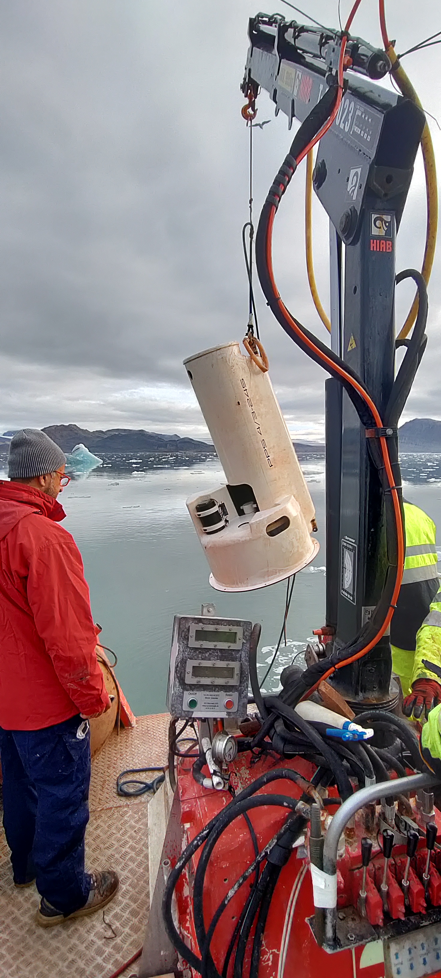
This dataset comprises measurements from moored sediment trap, collected by the Mooring Dirigibile Italia (MDI), which is managed by the Institute of Polar Sciences of the National Research Council (CNR). The data was gathered at Kongsfjorden, Svalbard Island, since 9 September 2010. This dataset is also part of the SIOS-Svalbard Integrated Arctic Earth Observing System, developed to observe the impacts of climate change, including the rapid loss of sea ice cover, the retreat of local glaciers, and the Atlantification of Arctic seas. Measured properties are: Total Sedimentation flux , Sedimentation flux of organic carbon in the water column, Sedimentation flux of total nitrogen in the water column, Sedimentation flux of CaCO3 in the water column, Sedimentation flux of non-metallic inorganic species (opal) in the water column, Sedimentation flux of Organic Matter in the water column, Sedimentation flux of lithogenic fraction in the water column. The zooplankton swimmers and sinkers collected by sediment traps are analysed in term of composition and morpho-functional traits.
-
pH tipping point in Svalbard (pHinS) The project is focused on carbonate chemistry in the fjord and measure how meltwater, icebergs and freshwater runoff affects the acidity of coastal seawater. Acquisition of CTD profiles and seawater samples at discrete depths (surface, bottom and 1-3 intermediate depths) to determine pH, total alkalinity, dissolved inorganic carbon, dissolved oxygen, nutrients, dissolved organic carbon. Collection of samples from icebergs and streams to determine the same set of parameters measured in the seawater. Some of the analysis were performed in the laboratory of the “Dirigibile Italia” Arctic station soon after the collection; others will be performed on preserved samples in ISMAR’s laboratories. 62 water column profiles of pressure, Temperature, salinity, dissolved oxygen, turbidity instrument: SBE19plus
-
ISotopic and physical-chemical MOnitoring of GLACial drainages and sea water in the Ny-Ålesund area (Svalbard) (ISMOGLAC) Sampling and in-situ measurements on snow and water, performed into both Kongsfjorden and glacial streams that originate in supraglacial, englacial and subglacial zones of different glaciers (Midtre Lovenbreen, Austre broggerbreen, Vestre Broggerbreen, Kongsvegen). Dataset concerns water isotopes signature of snow and Kongsfjorden water and physical-chemical data of the latter.
-

Permafrost Release Into The Marine System In A Warming Arctic (PRIMA) Data about Physical and chemical oceanography and vertical fluxes of sedimentary material from Mooring Aldo Pontremoli (MAP) and geochemical biomarker data from sediment core. Instrument: SBE56, SBE37, Sediment trap Technicap PPS 4/3, GC-MS
-
Arctic Metrology (MeteoMet - Arcitc) Project start:2017-03-01 end: 2022-02-01 Field calibration of thermometers for air, soil, permafrost and water temperature measurements using special transportable chamber and dedicated calibration procedures. Evaluation of field measurement uncertainty. Calibration of different kind of instruments and sensors. Dedicated calibration procedures. Documented traceability to SI standards. Field measurement uncertainty evaluations.
-

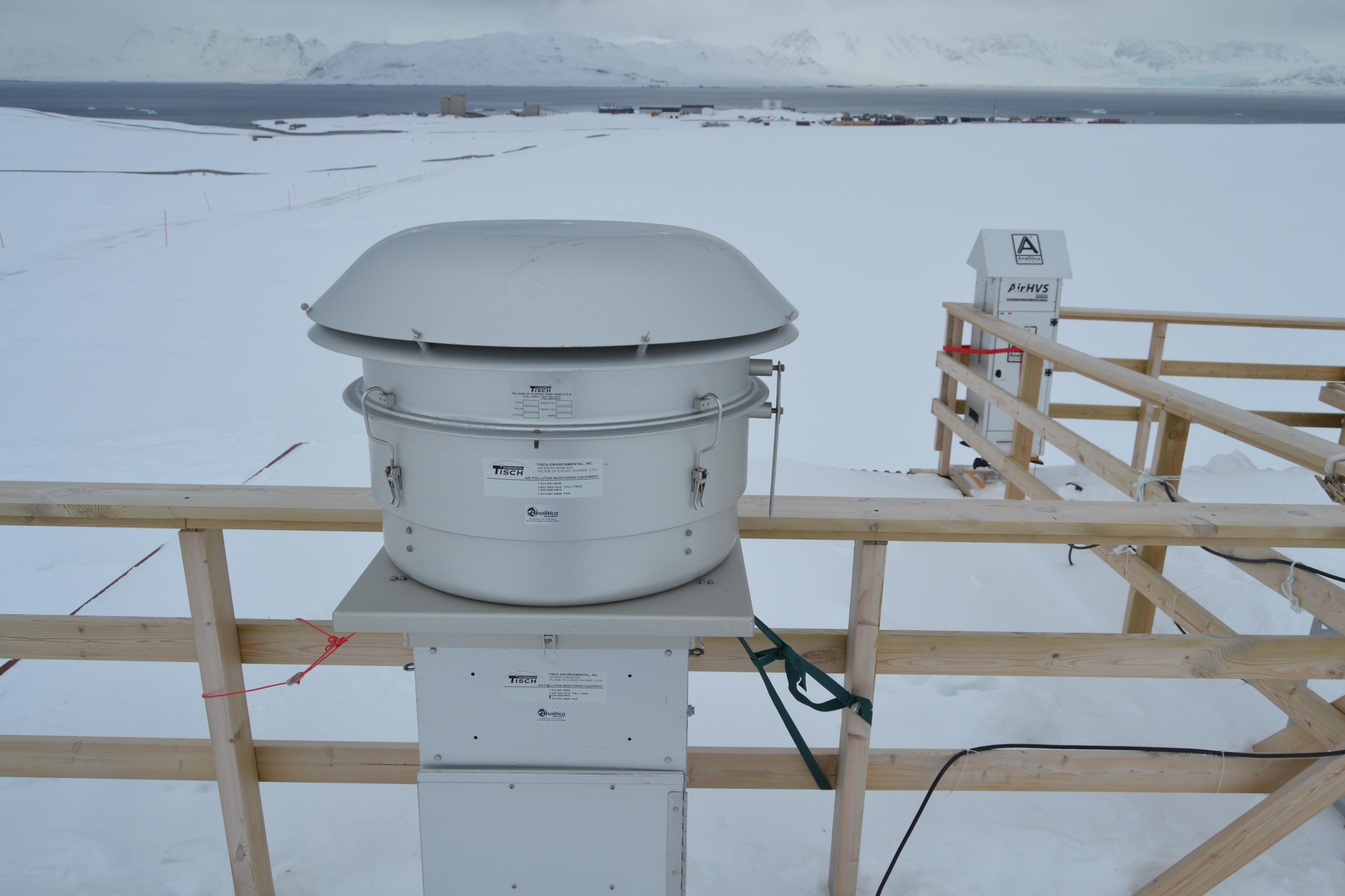
Aerosol Biogeochemical cycles, Sources and TRansport processes in the climate-sensitive ArCTic - ABSTRACT Dataset consists in: Aerosol load, Ion, metal, EC/OC measurements on bulk and size-segregated particulate matter at Gruvebadet Observatory (Ny Alesund - Italian Station "Dirigibile Italia") using Aerosol sampling and measurement devices (TECORA ECHO-PM, TECORA Skypost, TECORA HI-VOL, FAI PBL, TSI SMPS, TSI APS - Ion Chromatographs, ICP-AES, Thermo-Optical Analyzer, ICP-MS) Aerosol measurements and sampling. Atmospheric Particle Size Distribution. SMPS (10-500 nm) and APS (0.5-20 um). PM10 aerosol low volume sampling for determination of ions and metals: continuous 24/48h resolution samplings. Multi-stage impactor (Dekati 4-stage: < 1 um - > 10 um) for measurement of ion composition: 4-day resolution sampling. PM10 medium volume sampling for determination of metal content and Pb isotope ratios: 4-d resolution samplings. PM10 on quartz filters for determination of Elemental od Organic Carbon (EC/OC): continuous 24/48 h resolution samplings. PM10 aerosol low volume sampling on PTFE for elemental determination by PIXE technique.
-
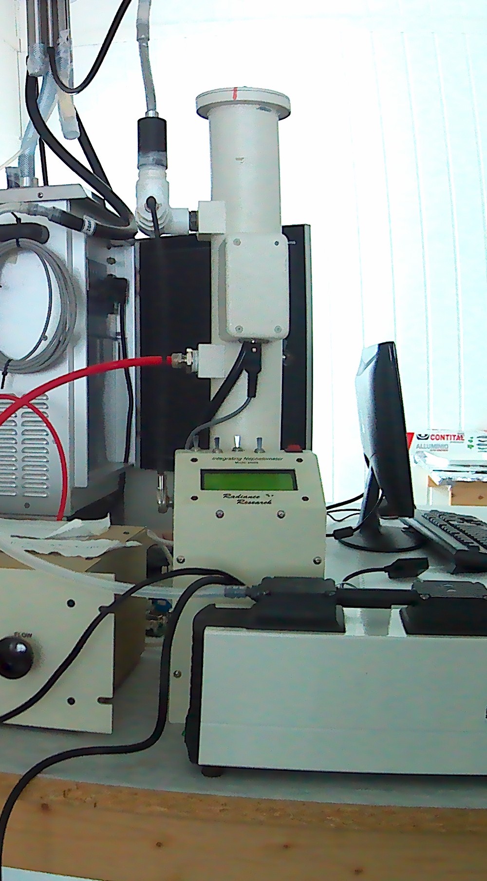
Aerosol scattering at 1 wavelength (530 nm) measured using a nephelometer M903, manufactured by Radiance Research.