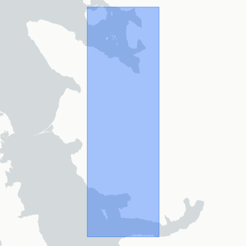
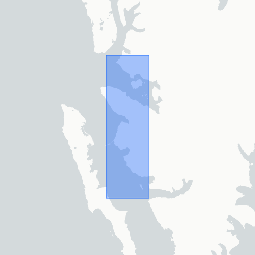
Hydrography
Type of resources
IADC Research Activities
Topics
Keywords
Contact for the resource
Provided by
Years
Formats
Representation types
Update frequencies
status
Scale
-
The dataset includes fourteen seawater surface sampling points taken with Niskin bottles on board the MS-Teisten (Kings Bay)
-

Time series of marine particles fluxes and its compositions (Time and spatial scale: 15-90 days, fixed depth 83 m, 17 m above bottom). Flux of total mass, TMF, (g m-2 day-1) - Organic Carbon, OC, (per cent) - Calcium carbonate,CaCO3, (per cent) - Biogenic silica, Opal, (per cent) - Lithogenic material, Litho, (per cent) - Delta 13C, d13C, (per mil)
-
Freshwater input in the Kongsfjorden (FIKO) Project Start: 2010-06-01 End:2020-12-31 FIKO project aims to acquire measurements of the chemical and physical characteristics of water masses in Kongsfjorden, and estimate the amount of fresh water released from glaciers, in order to study the interactions of this water with the warmer Atlantic waters. The dataset consist of water column profiles of pressure, temperature, salinity, fluorescence and turbidity located within the Kongsfjorden at Platform: MS Teisten - Kings Bay AS, vertical resolution 0.5 m Kongsfjorden_CTD_profiles_2013: 48 water column profiles by SBE19plus CTD probe Kongsfjorden_CTD_profiles_2014: 42 water column profiles by SBE19plus CTD probe Kongsfjorden_CTD_profiles_2015: 82 water column profiles by SBE19plus CTD probe Kongsfjorden_CTD_profiles_2016: 34 water column profiles by SBE19plus CTD probe Kongsfjorden_CTD_profiles_2017: 5 water column profiles by SAIV A/S SD204 – CTD/STD Kongsfjorden_CTD_profiles_2018: 41 water column profiles by SAIV A/S SD204 – CTD/STD Kongsfjorden_CTD_profiles_2019: 12 water column profiles by SAIV A/S SD204 – CTD/STD Kongsfjorden_Krossfjorden_CTD_profiles_2020: 29 water column profiles by SBE19plus CTD probe in 3 different areas: Krossfjorden, kongsfjorden at one transect along the fjord axis, off Bayelva river area.
-

ISotopic and physical-chemical MOnitoring of GLACial drainages and sea water in the Ny-Ålesund area (Svalbard) The project concerns an isotopic and physical-chemical monitoring of inland glacial drainages and ocean water into Kongsfjorden. It is aimed at defining the dynamic processes of the glacial melting and evaluating the consequent transfers of fresh water towards the Arctic Ocean. The dataset includes the continuous measurements (1 data/15 min) performed during summer season by a CTD diver. Parameter: Temperature, electical conductivity, water level.
-
This proposal will focus, by means of a multidisciplinary and well-balanced consortium on eutrophication, contaminants, marine litter and underwater noise descriptors of the MSFD. vertical acquisition in 18 CTD station in Kongsfjorden with water sampling at 2-3 depths (surface, intermediate, bottom)for nutrient and pH analyses of sampled water in the lab. parameters: Pressure, Strain Gauge [db]rnTemperature [IPTS-68, deg C]rnConductivity [mS/cm]rnpHrnOxygen, SBE 43 [ml/l]rnTurbidity, Turner Cyclops [NTU] Pressure, Strain Gauge [db]rnTemperature [IPTS-68, deg C]rnConductivity [mS/cm]rnpHrnOxygen, SBE 43 [ml/l]rnTurbidity, Turner Cyclops [NTU]
-
pH tipping point in Svalbard (pHinS) The project is focused on carbonate chemistry in the fjord and measure how meltwater, icebergs and freshwater runoff affects the acidity of coastal seawater. Acquisition of CTD profiles and seawater samples at discrete depths (surface, bottom and 1-3 intermediate depths) to determine pH, total alkalinity, dissolved inorganic carbon, dissolved oxygen, nutrients, dissolved organic carbon. Collection of samples from icebergs and streams to determine the same set of parameters measured in the seawater. Some of the analysis were performed in the laboratory of the “Dirigibile Italia” Arctic station soon after the collection; others will be performed on preserved samples in ISMAR’s laboratories. 62 water column profiles of pressure, Temperature, salinity, dissolved oxygen, turbidity instrument: SBE19plus
-
ISotopic and physical-chemical MOnitoring of GLACial drainages and sea water in the Ny-Ålesund area (Svalbard) The dataset includes vertical profiles of physical-chemical performed on-site in different sites along the fjord in Kongsfjorden.
-
ISotopic and physical-chemical MOnitoring of GLACial drainages and sea water in the Ny-Ålesund area (Svalbard) The data are related to in-situ measurements of the physical-chemical parameters (temperature, electrical conductivity, pH, alkalinity), performed by portable device during summer period, starting from the higher sector of the glaciers (Midtre Lovenbreen, Austre broggerbreen, Vestre Broggerbreen, Kongsvegen, Pedersenbreen), where the first melt water is encountered, continuing towards the glaciers terminus, both laterally and centrally, and downstream, on the proglacial rivers, up to the sea.
-
Continuous physical-chemical monitoring (1 measurement each 15 min) performed by a CTD probe and a turbidity sensor installed at the Bayelva river near the new bridge. Measurements are carried out during summer period, from the beginning of the melting season to beginning of autumn when the water start freezing. The data were generated thanks to the following funding sources: ICEtoFLUX (2022 to 2025) and UNDER (2025).
-
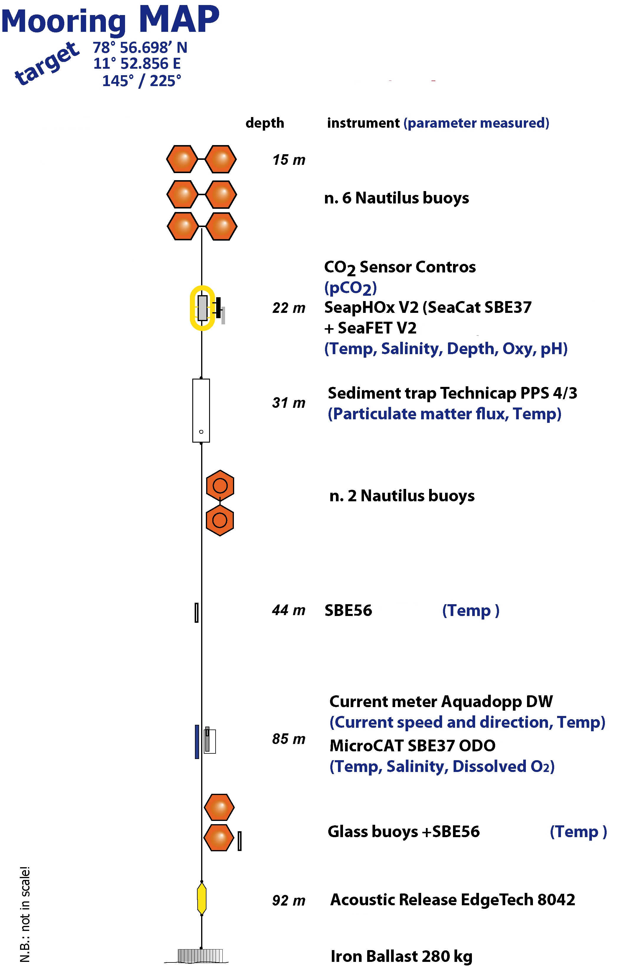
The Aldo Pontremoli Mooring (MAP), operated by the Institute of Polar Sciences of the National Research Council (CNR), has been active in the Kongsfjord, located in the Svalbard archipelago, since September 11, 2020. It is situated near the mouth of Bayelva River mouth and is influenced by land terminating glaciers and the release of permafrost. Currently, the mooring line is equipped with various instruments positioned at depths ranging from 22 to 97 meters within the water column. These instruments collect a wide array of physical and biogeochemical Essential Ocean Variables, including seawater pressure, temperature, conductivity, salinity, currents, dissolved oxygen concentration, pH, particle fluxes and dissolved carbon dioxide concentration. This activity is part of the Svalbard Integrated Arctic Earth Observing System (SIOS), which aims to monitor the impacts of climate change, such as the rapid loss of sea ice cover, the retreat of local glaciers, and the Atlantification of Arctic seas. Time series acquisition is ongoing and will continue, supported by funding from JRA ENI-CNR. The project's goal is to analyse the environmental feeback related to the material released into the marine environment due to permafrost melting. Reactivated permafrost can have significant consequences for both climate and the environment by contributing to the release of greenhouse gases into the atmosphere and pollutants into aquatic ecosystems.