SVALBARD AND JAN MAYEN
Type of resources
Available actions
IADC Research Activities
Topics
Keywords
Contact for the resource
Provided by
Years
Formats
Representation types
Update frequencies
status
Scale
-
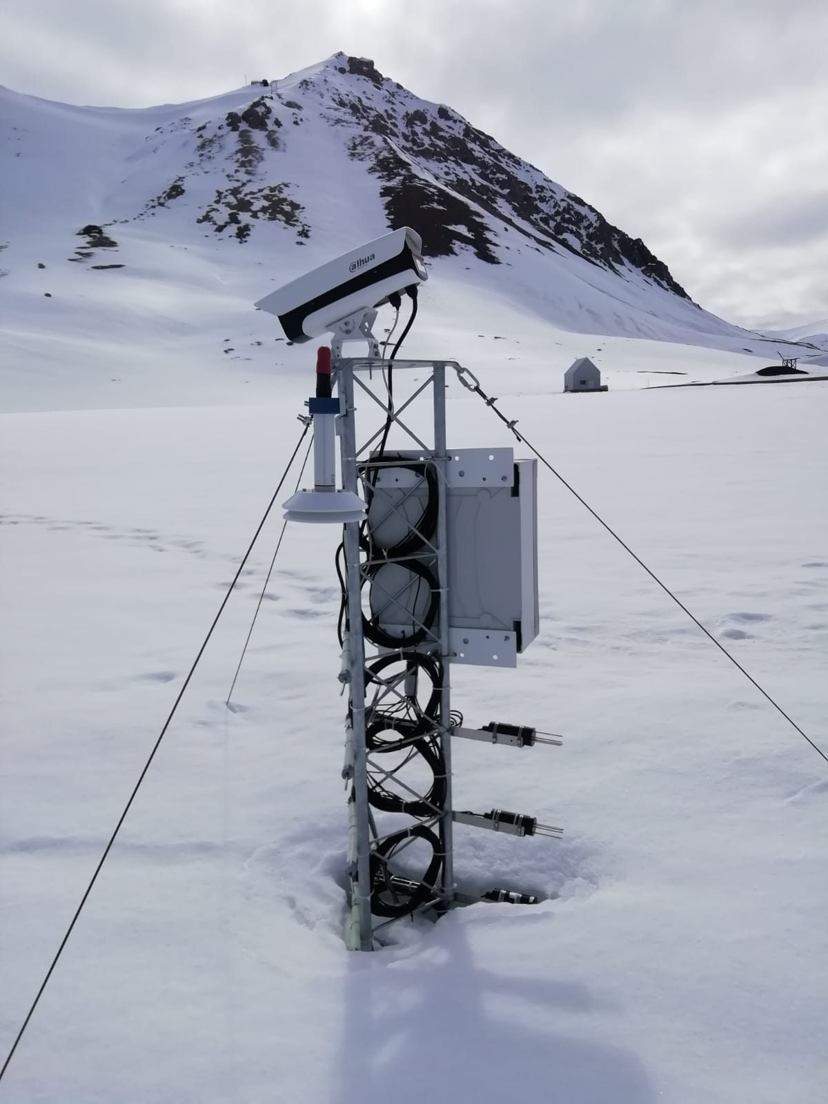
Snow water equivalent at the Gruvebadet Snow Resarch Site
-

Chronobiology of polar organisms (Chronopolar) Monitoring water parameters in surface and deep (3.0 meters) using DS18B20 + rasberry-pi. Sample collection: Lepidurus arcticus.
-

Ice Nuclei Particle Concentration (INPAIR) INPAIR Svalbard' Chemistry and Physics of the Atmosphere: Ice nucleating particle (INPs) concentration obtained in spring and summer campaigns in the Arctic Region. Measurements of INPs concentrations and activation fraction of aerosol in Arctic (e.g. Gruvebadet observatory in Ny-Ãlesund). b) Correlating INPs concentration with meteorological parameters and physicochemical characterisations. Instrument: PM1 and PM10 sampling lines. DFPC chamber
-

Isotopic characterisation of arcic ponds Sampling of ponds and surrouding terrestrial envionrment. matter (expressed as ash fry dry matter) and N content as a percentage in soil and lake sediment.
-

The automated nivological station was installed in November 2020 in a flat area over the tundra about 80 meters far from the Gruvebadet Atmospheric Laboratory and nearby a snow sampling site from where weekly snow samples are collected for chemical analysis. Sensors (Pt100 1/3 DIN) have been calibrated by their companies before installation and are connected to a datalogger for continuous acquisition. For all the parameters, data are logged with 10-minute time resolution and then averaged over 1 hour. This activity is carried out by the Aldo Pontremoli Centre part of the Joint Research Agreement ENI-CNR, in the framework of the SnowCorD project (SIOS Core Data).
-
Mixing state and organic volume fractions of sub micron aerosol particles collected at the Zeppelin observatory
-

Monitoring of Aerosol: Short and Long range source areas related to Climate Change (MAShLoCC) During the Arctic campaign 2010, an atmospheric aerosol sampling at the Gruvebadet observatory has been carried out in order to obtain information about the formation and composition of atmospheric aerosol, transport processes toward the Arctic zone as well as local and remote source areas. Instrument : ICP-SFMS, IRMS, Orbitrap
-

Atmospheric Gondola for Aerosol Profiles (AGAP) The scientific goals of AGAP are to develop novel aerosol payloads and evaluate the vertical distribution of aerosol properties in the Arctic Boundary Layer. Dataset consists in Aerosol vertical profiles gridded at a 50 m spatial resolution: R, T, P, RH, Aerosol size distribution, BC concentration, O3. Maximum altitudes 1500 m.
-

RIS: 11028 Spatial Distributions of Black Carbon and Mineral Dust in Air and Snow Surface Layers upon Svalbard Glaciers (BC-3D) Project Start: 2018-03-01 End: 2020-06-30 The scientific goals of BC-3D are to evaluate the distribution of Black Carbon and Mineral Dust in the first layers of atmosphere and surface snow over targeted Svalbard glaciers in order to identify the mechanisms of the air/snow exchanges also assisted by model predictions to provide the full 3D picture. Aerosol vertical profiles gridded at a 50 m spatial resolution: R, T, P, RH, Aerosol size distribution, BC concentration. Maximum altitudes 1500 m.
-
The Climate Change Tower Integrated Project (CCT-IP) represents the guide lines of the italian research in the arctic and aims to study the interaction between all the components of the climate system in the Arctic. The Amundsen-Nobile Climate Change Tower (CCT) is the key infrastructure of the project, and provides continuous acquisition of the atmospheric parameters at different heights as well as at the interface between the surface and the atmosphere. Images of the sky are taken every 15 minutes and are available under request.