Type of resources
Available actions
IADC Research Activities
Topics
Keywords
Contact for the resource
Provided by
Years
Formats
Representation types
Update frequencies
status
Scale
-
Atmospheric Gondola for Aerosol Profiles (AGAP) The scientific goals of AGAP are to develop novel aerosol payloads and evaluate the vertical distribution of aerosol properties in the Arctic Boundary Layer. Dataset consists in Aerosol vertical profiles gridded at a 50 m spatial resolution: R, T, P, RH, Aerosol size distribution, BC concentration, O3. Maximum altitudes 1500 m.
-
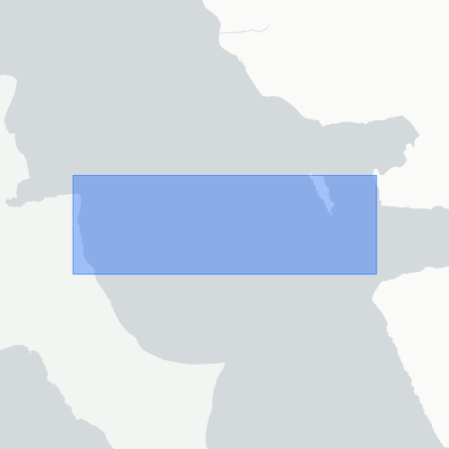
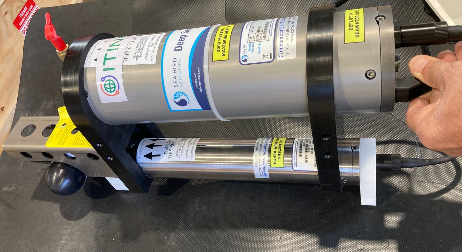
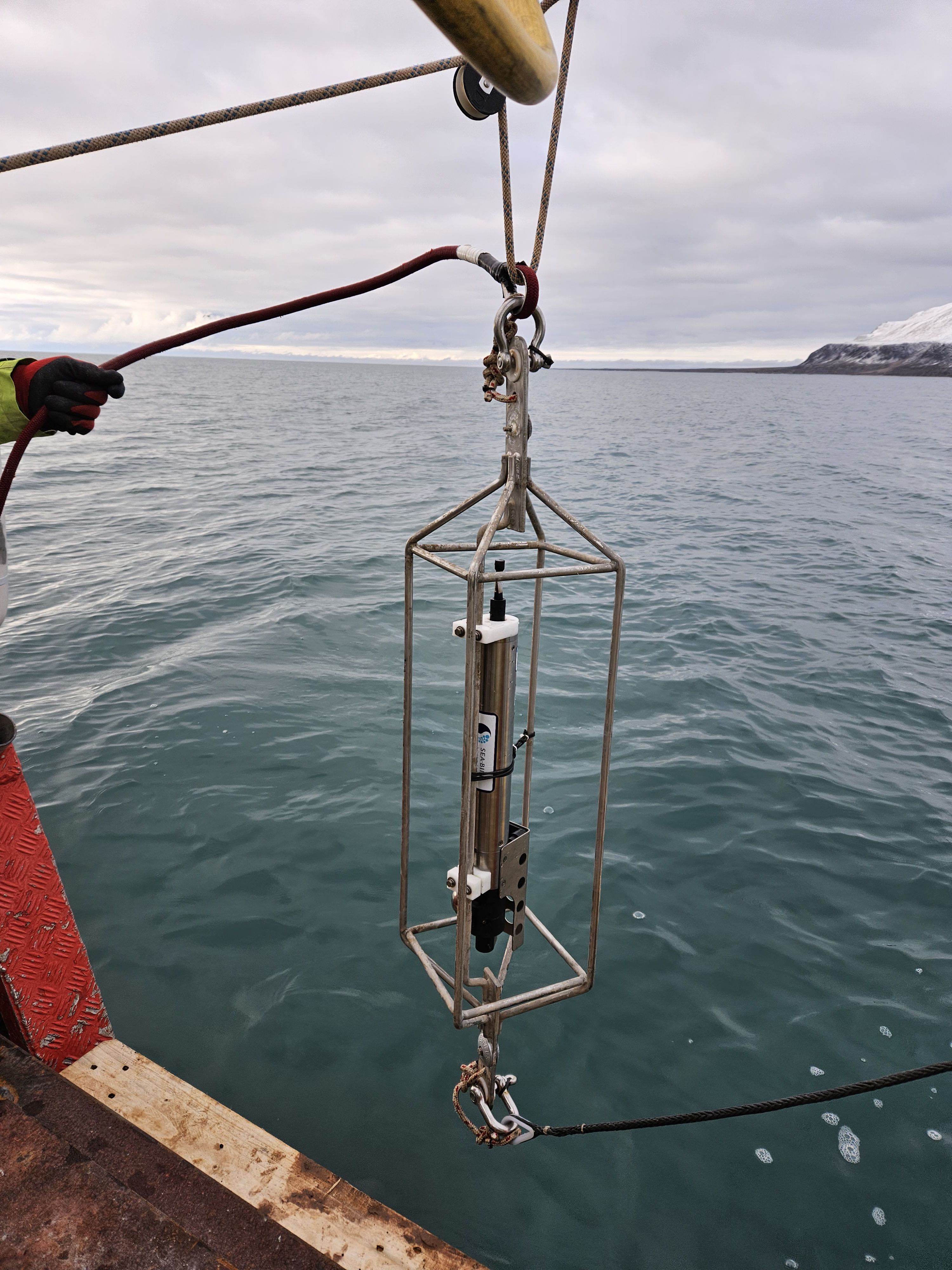
This dataset comprises measurements from S1 Mooring, which is managed by the Institute of Polar Sciences of the National Research Council (CNR) and National Institute of Oceanography and Applied Geophysics (OGS). The data was gathered on the Fram Strait south of the Spitsbergen in an open-sea area strongly influenced by both the interaction between Atlantic (northward-moving) and Arctic (southward-moving) waters as well as by the presence and winter formation of sea ice and atmospheric forcing. To understand these dynamics, a deep-water oceanographic S1 Mooring was anchored at about 1040 meters depth, since June 2014 and is part of the SIOS-Svalbard Integrated Arctic Earth Observing System, developed to observe the impacts of climate change, including the rapid loss of sea ice cover, the retreat of local glaciers, and the Atlantification of Arctic seas. The temperature sensor mounted at 893 m measures sea-water temperature. The acquisition of this time series data is still ongoing and will continue, bolstered by the inclusion of this infrastructure within the framework of the Italian PNRR project ITINERIS. This ensures sustained data collection and further enhances our understanding of the observed environmental changes.
-
ISotopic and physical-chemical MOnitoring of GLACial drainages and sea water in the Ny-Ålesund area (Svalbard) The data are related to in-situ measurements of the physical-chemical parameters (temperature, electrical conductivity, pH, alkalinity), performed by portable device during summer period, starting from the higher sector of the glaciers (Midtre Lovenbreen, Austre broggerbreen, Vestre Broggerbreen, Kongsvegen, Pedersenbreen), where the first melt water is encountered, continuing towards the glaciers terminus, both laterally and centrally, and downstream, on the proglacial rivers, up to the sea.
-
This dataset comprises measurements from moored multiparametric probe, collected by the Aldo Pontremoli Mooring (MAP), which is managed by the Institute of Polar Sciences of the National Research Council (CNR). The Aldo Pontremoli Mooring (MAP), operated by the Institute of Polar Sciences of the National Research Council (CNR), has been active in the Kongsfjord, located in the Svalbard archipelago, since September, 2020. The instrument collect a wide array of physical and biogeochemical Essential Ocean Variables, including seawater pressure, temperature, conductivity, salinity, dissolved oxygen concentration and pH. This activity is part of the Svalbard Integrated Arctic Earth Observing System (SIOS), which aims to monitor the impacts of climate change, such as the rapid loss of sea ice cover, the retreat of local glaciers, and the Atlantification of Arctic seas. Time series acquisition is ongoing and will continue, supported by funding from JRA ENI-CNR. The project's goal is to analyse the environmental feeback related to the material released into the marine environment due to permafrost melting. Reactivated permafrost can have significant consequences for both climate and the environment by contributing to the release of greenhouse gases into the atmosphere and pollutants into aquatic ecosystems
-
Continuous physical-chemical monitoring (1 measurement each 15 min) performed by a CTD probe and a turbidity sensor installed at the Bayelva river near the new bridge. Measurements are carried out during summer period, from the beginning of the melting season to beginning of autumn when the water start freezing. The data were generated thanks to the following funding sources: ICEtoFLUX (2022 to 2025) and UNDER (2025).
-
Atlantification of Arctic ocean is causing a sharp increase in temperature and salinity around Svalbard Islands and in Kongsfjorden. Such phenomenon and the input of sediment-rich glacial meltwater influence salinity, water column turbidity, and light penetration with ecological implications on the microbial features.
-

Holocene environmental change on Svalbard (HOLS) The aim of this international umbrella project is to study the variation of environment and climate in Svalbard during the Holocene. At the moment no integrated temperature or precipitation record exists for the entire Holocene on Svalbard. We aim to reconstruct temperature and precipitation for the Holocene by using a combination of lake sediment records, proglacial lakes and glacial moraine records. By analysing proxies as chironomids, alkenones, macro fossils and DNA temperatures can be reconstructed. Proglacial lake sediments and glacial moraine records help to reconstruct former ELA of glaciers and can be used to reconstruct precipitation records in combination with available temperature records.
-
This dataset comprises measurements from a moored CTD instruments, collected by the Krossfjord Italian Mooring (KIM), which is managed by the Institute of Polar Sciences of the National Research Council (CNR). The data was gathered in the Krossfjord, Svalbard Island, since September 2020. This dataset is also part of the SIOS-Svalbard Integrated Arctic Earth Observing System, developed to observe the impacts of climate change, including the rapid loss of sea ice cover, the retreat of local glaciers, and the Atlantification of Arctic seas. Mesured properties: seawater pressure, temperature, conductivity, salinity, density, oxygen concentration. The acquisition of this time series data is still ongoing and will continue, bolstered by the inclusion of this infrastructure within the framework of the Italian PNRR project ITINERIS. This ensures sustained data collection and further enhances our understanding of the observed environmental changes.
-
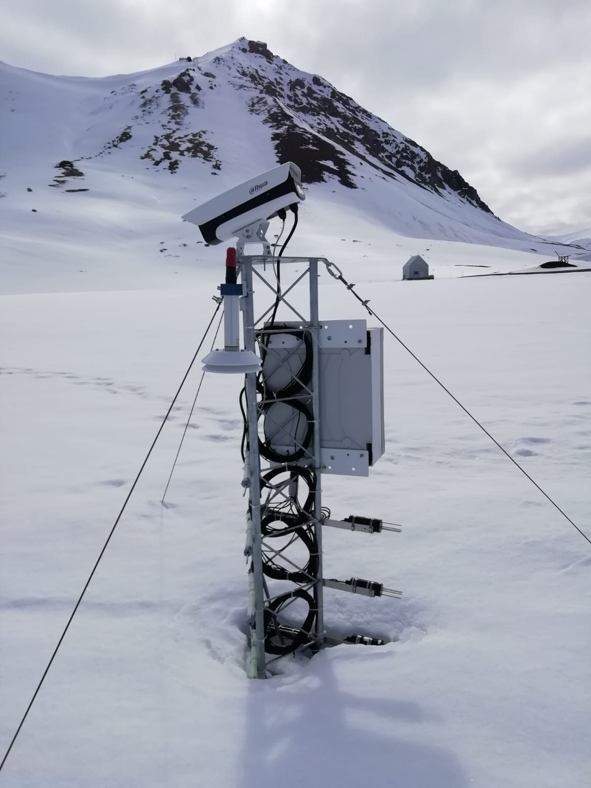
The automated nivological station was installed in November 2020 in a flat area over the tundra about 80 meters far from the Gruvebadet Atmospheric Laboratory and nearby a snow sampling site from where weekly snow samples are collected for chemical analysis. Sensors (Pt100 1/3 DIN) have been calibrated by their companies before installation and are connected to a datalogger for continuous acquisition. For all the parameters, data are logged with 10-minute time resolution and then averaged over 1 hour. This activity is carried out by the Aldo Pontremoli Centre part of the Joint Research Agreement ENI-CNR, in the framework of the SnowCorD project (SIOS Core Data).
-
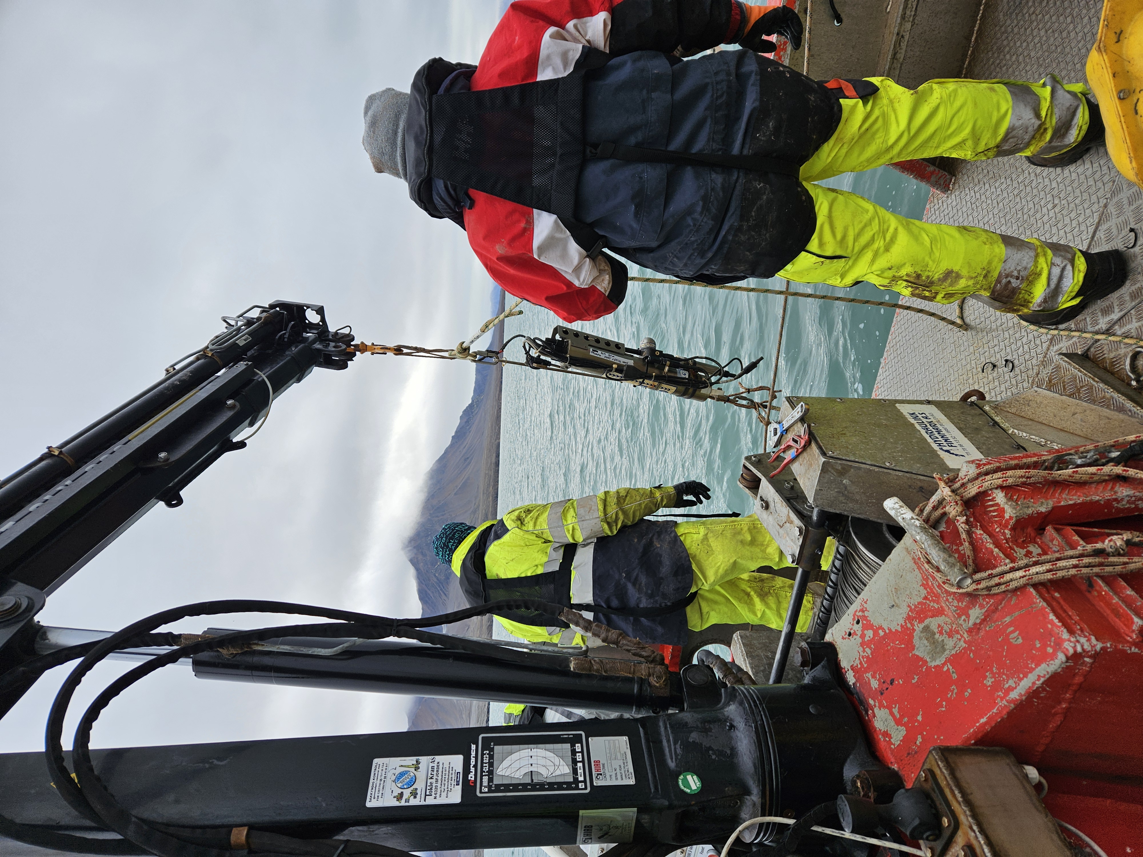
This dataset comprises measurements from a moored CTD instruments, collected by the Krossfjord Italian Mooring (KIM), which is managed by the Institute of Polar Sciences of the National Research Council (CNR). The data was gathered in the Krossfjord, Svalbard Island, since September 2020. This dataset is also part of the SIOS-Svalbard Integrated Arctic Earth Observing System, developed to observe the impacts of climate change, including the rapid loss of sea ice cover, the retreat of local glaciers, and the Atlantification of Arctic seas. Mesured properties: seawater pressure, temperature, conductivity, salinity, density, oxygen concentration. The acquisition of this time series data is still ongoing and will continue, bolstered by the inclusion of this infrastructure within the framework of the Italian PNRR project ITINERIS. This ensures sustained data collection and further enhances our understanding of the observed environmental changes.