2025
Type of resources
Available actions
Topics
Keywords
Contact for the resource
Provided by
Years
Formats
Representation types
Update frequencies
status
Scale
-
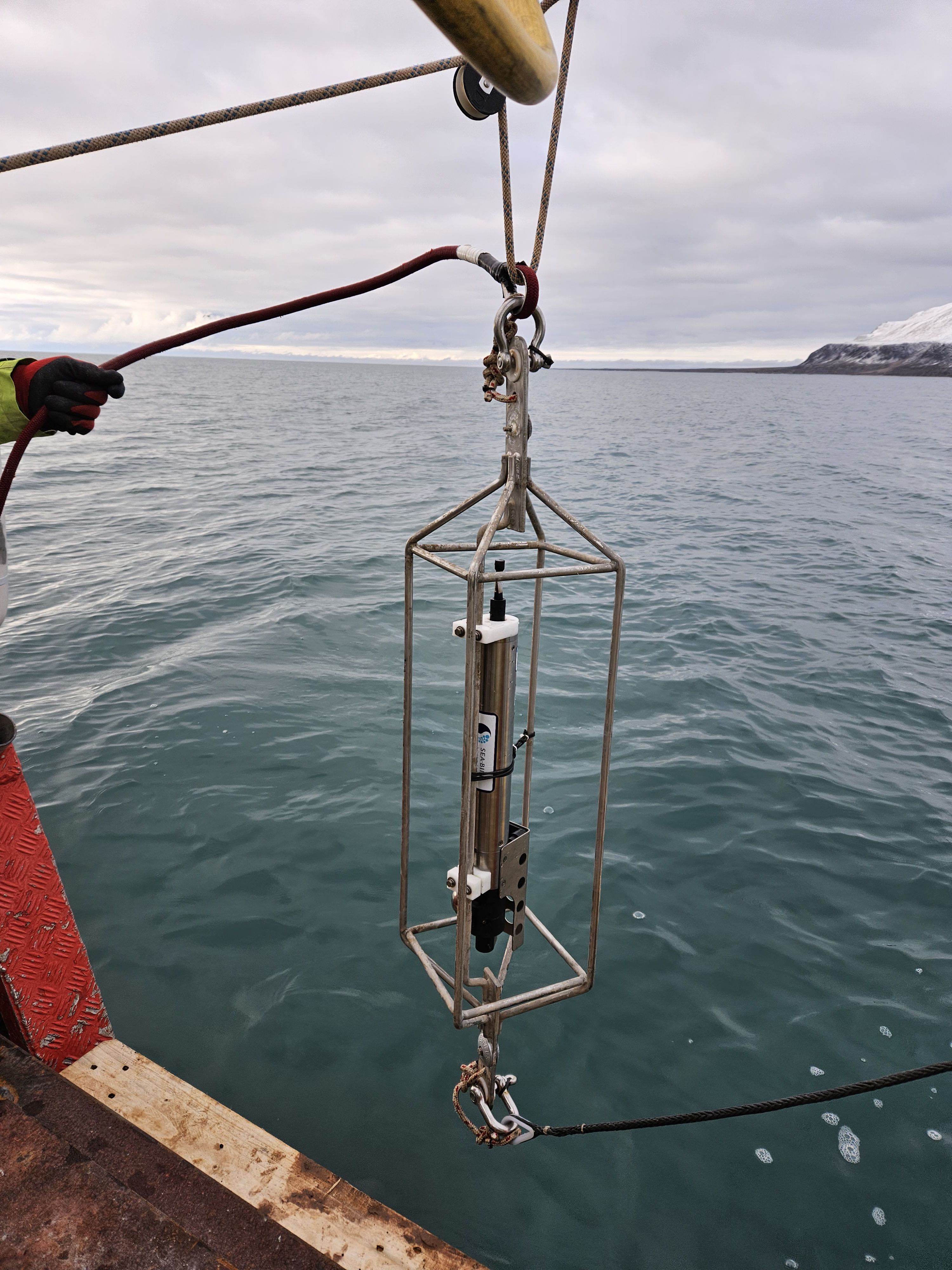
This dataset comprises measurements from S1 Mooring, which is managed by the Institute of Polar Sciences of the National Research Council (CNR) and National Institute of Oceanography and Applied Geophysics (OGS). The data was gathered on the Fram Strait south of the Spitsbergen in an open-sea area strongly influenced by both the interaction between Atlantic (northward-moving) and Arctic (southward-moving) waters as well as by the presence and winter formation of sea ice and atmospheric forcing. To understand these dynamics, a deep-water oceanographic S1 Mooring was anchored at about 1040 meters depth, since June 2014 and is part of the SIOS-Svalbard Integrated Arctic Earth Observing System, developed to observe the impacts of climate change, including the rapid loss of sea ice cover, the retreat of local glaciers, and the Atlantification of Arctic seas. The dataset is related to instrument mounted at 834 m during the 2023 - 2024 survey. The instrument measures sea-water temperature, conductivity and oxygen and related salinity and density anonaly. The acquisition of this time series data is still ongoing and will continue, bolstered by the inclusion of this infrastructure within the framework of the Italian PNRR project ITINERIS. This ensures sustained data collection and further enhances our understanding of the observed environmental changes.
-

Concentration data for Sulfuric Acid (SA), Methane Sulfonic Acid (MSA) and Iodic Acid (IA) - in molecule per cubic centimeter (#.cm-3). Averaging time 60 min.
-

2018 NAIS at Gruvebadet.
-
This dataset comprises measurements from a moored thermistor, collected by the Krossfjord Italian Mooring (KIM), which is managed by the Institute of Polar Sciences of the National Research Council (CNR). The data was gathered in the Krossfjord, Svalbard Island, since September 2020. This dataset is also part of the SIOS-Svalbard Integrated Arctic Earth Observing System, developed to observe the impacts of climate change, including the rapid loss of sea ice cover, the retreat of local glaciers, and the Atlantification of Arctic seas. Mesured properties: seawater temperature. The acquisition of this time series data is still ongoing and will continue, bolstered by the inclusion of this infrastructure within the framework of the Italian PNRR project ITINERIS. This ensures sustained data collection and further enhances our understanding of the observed environmental changes.
-
This dataset comprises measurements from a moored CTD instruments, collected by the Krossfjord Italian Mooring (KIM), which is managed by the Institute of Polar Sciences of the National Research Council (CNR). The data was gathered in the Krossfjord, Svalbard Island, since September 2020. This dataset is also part of the SIOS-Svalbard Integrated Arctic Earth Observing System, developed to observe the impacts of climate change, including the rapid loss of sea ice cover, the retreat of local glaciers, and the Atlantification of Arctic seas. Mesured properties: seawater pressure, temperature, conductivity, salinity, density, oxygen concentration. The acquisition of this time series data is still ongoing and will continue, bolstered by the inclusion of this infrastructure within the framework of the Italian PNRR project ITINERIS. This ensures sustained data collection and further enhances our understanding of the observed environmental changes.
-
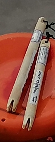
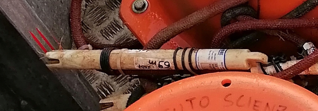
This dataset comprises measurements from thermistor (SBE56) mounted on the Mooring Dirigibile Italia (MDI), which is managed by the Institute of Polar Sciences of the National Research Council (CNR). The mooring is placed in the Kongsfjorden, Svalbard Island, since September 2010 and the thermistor is placed at the nominal depths between 51 and 59 m and is operative from September 2012. This dataset is also part of the SIOS-Svalbard Integrated Arctic Earth Observing System, developed to observe the impacts of climate change, including the rapid loss of sea ice cover, the retreat of local glaciers, and the Atlantification of Arctic seas. Measured properties are: sea-water temperature. The acquisition of this time series data is still ongoing and will continue, bolstered by the inclusion of this infrastructure within the framework of the Italian PNRR project ITINERIS. This ensures sustained data collection and further enhances our understanding of the observed environmental changes.
-
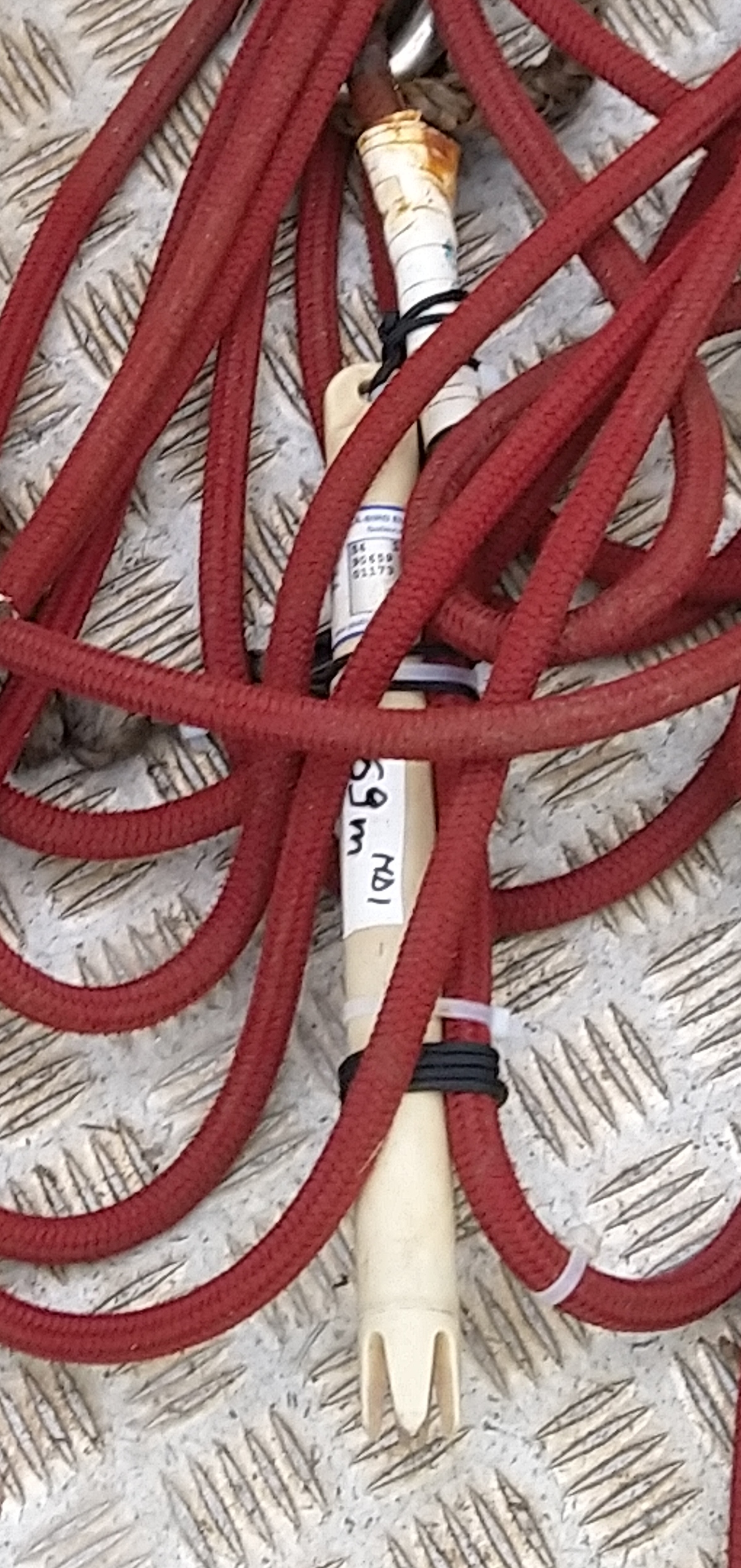
This dataset comprises measurements from thermistor (SBE56) mounted on the Mooring Dirigibile Italia (MDI), which is managed by the Institute of Polar Sciences of the National Research Council (CNR). The mooring is placed in the Kongsfjorden, Svalbard Island, since September 2010 and the thermistor is placed at the nominal depths between 62 and 69 m and is operative from May 2013. This dataset is also part of the SIOS-Svalbard Integrated Arctic Earth Observing System, developed to observe the impacts of climate change, including the rapid loss of sea ice cover, the retreat of local glaciers, and the Atlantification of Arctic seas. Measured properties are: sea-water temperature. The acquisition of this time series data is still ongoing and will continue, bolstered by the inclusion of this infrastructure within the framework of the Italian PNRR project ITINERIS. This ensures sustained data collection and further enhances our understanding of the observed environmental changes.
-
This dataset comprises measurements from moored Sediment Trap mounted on S1 Mooring. The mooring is managed by the Institute of Polar Sciences of the National Research Council (CNR) and National Institute of Oceanography and Applied Geophysics (OGS). The data was gathered on the Fram Strait south of the Spitsbergen in an open-sea area strongly influenced by both the interaction between Atlantic (northward-moving) and Arctic (southward-moving) waters as well as by the presence and winter formation of sea ice and atmospheric forcing. To understand these dynamics, a deep-water oceanographic S1 Mooring was anchored at about 1040 meters depth, since June 2014 and is part of the SIOS-Svalbard Integrated Arctic Earth Observing System, developed to observe the impacts of climate change, including the rapid loss of sea ice cover, the retreat of local glaciers, and the Atlantification of Arctic seas. Mesured properties: Total Sedimentation flux , Sedimentation flux of organic carbon in the water column, Sedimentation flux of total nitrogen in the water column, Sedimentation flux of CaCO3 in the water column, Sedimentation flux of non-metallic inorganic species (opal) in the water column, Sedimentation flux of Organic Matter in the water column, Sedimentation flux of lithogenic fraction in the water column
-

2024 NAIS at Gruvebadet
-
This dataset comprises measurements from moored Acustic Doppler Current Profiler (ADCP), collected by the S1 Mooring, which is managed by the Institute of Polar Sciences of the National Research Council (CNR) and National Institute of Oceanography and Applied Geophysics (OGS). The data was gathered on the Fram Strait south of the Spitsbergen in an open-sea area strongly influenced by both the interaction between Atlantic (northward-moving) and Arctic (southward-moving) waters as well as by the presence and winter formation of sea ice and atmospheric forcing. The easternmost part of the Fram Strait, relatively warm and salty Atlantic waters flow, bringing heat to the Arctic region and contributing to the Atlantification phenomenon. The processes responsible of the inter-annual and seasonal variability of the deep current flow in this open sea region are still unknown and also what the implications are related to ongoing climate change and in particular to the progressive decrease of sea ice cover in the winter period. To understand these dynamics, a deep-water oceanographic S1 Mooring was anchored at about 1040 meters depth, since June 2014. The dataset is also part of the SIOS-Svalbard Integrated Arctic Earth Observing System, developed to observe the impacts of climate change, including the rapid loss of sea ice cover, the retreat of local glaciers, and the Atlantification of Arctic seas. The ADCP mounted at 420 m measure: sea-water currents intensity and direction along the water column. The acquisition of this time series data is still ongoing and will continue, bolstered by the inclusion of this infrastructure within the framework of the Italian PNRR project ITINERIS. This ensures sustained data collection and further enhances our understanding of the observed environmental changes.