time, latitude, longitude, depth, sea_water_temperature
Type of resources
Available actions
Topics
Keywords
Contact for the resource
Provided by
Years
Formats
Representation types
Update frequencies
status
Scale
-
This dataset comprises measurements from a moored thermistor, collected by the Krossfjord Italian Mooring (KIM), which is managed by the Institute of Polar Sciences of the National Research Council (CNR). The data was gathered in the Krossfjord, Svalbard Island, since September 2020. This dataset is also part of the SIOS-Svalbard Integrated Arctic Earth Observing System, developed to observe the impacts of climate change, including the rapid loss of sea ice cover, the retreat of local glaciers, and the Atlantification of Arctic seas. Mesured properties: seawater temperature. The acquisition of this time series data is still ongoing and will continue, bolstered by the inclusion of this infrastructure within the framework of the Italian PNRR project ITINERIS. This ensures sustained data collection and further enhances our understanding of the observed environmental changes.
-
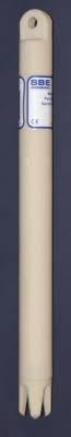
This dataset comprises measurements from thermistor (SBE56) mounted on the Mooring Dirigibile Italia (MDI), which is managed by the Institute of Polar Sciences of the National Research Council (CNR). The mooring is placed in the Kongsfjorden, Svalbard Island, since September 2010 and the thermistor is placed at the nominal depths between 51 and 59 m and is operative from September 2012. This dataset is also part of the SIOS-Svalbard Integrated Arctic Earth Observing System, developed to observe the impacts of climate change, including the rapid loss of sea ice cover, the retreat of local glaciers, and the Atlantification of Arctic seas. Measured properties are: sea-water temperature. The acquisition of this time series data is still ongoing and will continue, bolstered by the inclusion of this infrastructure within the framework of the Italian PNRR project ITINERIS. This ensures sustained data collection and further enhances our understanding of the observed environmental changes.
-

This dataset comprises measurements from thermistor (SBE56) mounted on the Mooring Dirigibile Italia (MDI), which is managed by the Institute of Polar Sciences of the National Research Council (CNR). The mooring is placed in the Kongsfjorden, Svalbard Island, since September 2010 and the thermistor at the nominal depths of 92 and 97 m was operative from June 2017 to August 2020. This dataset is also part of the SIOS-Svalbard Integrated Arctic Earth Observing System, developed to observe the impacts of climate change, including the rapid loss of sea ice cover, the retreat of local glaciers, and the Atlantification of Arctic seas. Measured properties are: sea-water temperature.
-
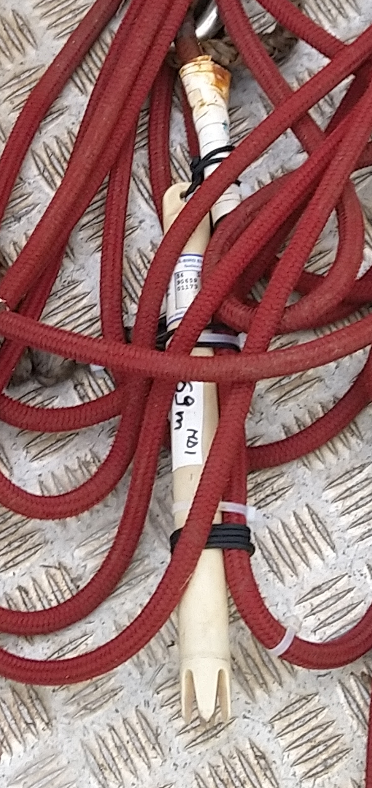
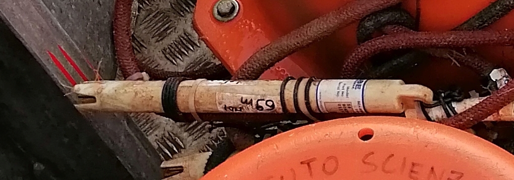
This dataset comprises measurements from thermistor (SBE56) mounted on the Mooring Dirigibile Italia (MDI), which is managed by the Institute of Polar Sciences of the National Research Council (CNR). The mooring is placed in the Kongsfjorden, Svalbard Island, since September 2010 and the thermistor is placed at the nominal depths between 62 and 69 m and is operative from May 2013. This dataset is also part of the SIOS-Svalbard Integrated Arctic Earth Observing System, developed to observe the impacts of climate change, including the rapid loss of sea ice cover, the retreat of local glaciers, and the Atlantification of Arctic seas. Measured properties are: sea-water temperature. The acquisition of this time series data is still ongoing and will continue, bolstered by the inclusion of this infrastructure within the framework of the Italian PNRR project ITINERIS. This ensures sustained data collection and further enhances our understanding of the observed environmental changes.
-
This dataset comprises measurements from a moored thermistor, collected by the Krossfjord Italian Mooring (KIM), which is managed by the Institute of Polar Sciences of the National Research Council (CNR). The data was gathered in the Krossfjord, Svalbard Island, since September 2020. This dataset is also part of the SIOS-Svalbard Integrated Arctic Earth Observing System, developed to observe the impacts of climate change, including the rapid loss of sea ice cover, the retreat of local glaciers, and the Atlantification of Arctic seas. Mesured properties: seawater temperature. The acquisition of this time series data is still ongoing and will continue, bolstered by the inclusion of this infrastructure within the framework of the Italian PNRR project ITINERIS. This ensures sustained data collection and further enhances our understanding of the observed environmental changes.