2026
Type of resources
Available actions
IADC Research Activities
Topics
Keywords
Contact for the resource
Provided by
Years
Formats
Representation types
Update frequencies
status
Scale
-

This resource contains seismic recording data acquired by a 24-sensor linear seismic array installed close to IFG1 pieazometer in Ny-Ålesund, Svalbard, in June 2026. The sensors were deployed along a linear array with an interstation spacing of 1 m, resulting in a total array aperture of 23 m. The seismic array acquired ambient seismic noise data for 1h and 45 minutes. Seismic data were recorded at a sampling frequency of 4000 Hz. The seismic recordings are provided as single-components MINISeed files. Along with the seismic data, there is provided the kml showing the position of the first and last sensors in the array configuration
-

This resource contains seismic recording data acquired by a 24-sensor seismic array installed near the Climate Change Tower in Ny-Ålesund, Svalbard, in June 2026. The sensors were deployed along a linear array with an interstation spacing of 1 m, resulting in a total array aperture of 23 m. The longitudinal axis of each sensor was oriented towards the N100° direction, which was also the orientation of the array. Active seismic surveys were performed using a 5 kg sledgehammer as the seismic source. The impacts were generated by striking the hammer on a metal plate coupled to the ground surface to ensure efficient energy transfer into the subsurface. Seismic data were recorded at a sampling frequency of 4000 Hz. The seismic recordings are provided as 2-second-long SEG-Y files starting from the shot time. Each file corresponds to the seismic response generated by a single individual shot and contains the data recorded by the seismic array following that source activation. Along with the seismic data, are here provided the kml showing the position of the first and last sensors in the array configuration, a xlsx file providing the correspondence between ID of the shots and respective offset, and a README docx file describing the nomenclature of the SEG-Y files.
-
This dataset comprises measurements from moored thermistor, collected by the Aldo Pontremoli Mooring (MAP), which is managed by the Institute of Polar Sciences of the National Research Council (CNR). The Aldo Pontremoli Mooring (MAP), operated by the Institute of Polar Sciences of the National Research Council (CNR), has been active in the Kongsfjord, located in the Svalbard archipelago, since September, 2020. The instrument collect physical Essential Ocean Variables, including sea water temperature. This activity is part of the Svalbard Integrated Arctic Earth Observing System (SIOS), which aims to monitor the impacts of climate change, such as the rapid loss of sea ice cover, the retreat of local glaciers, and the Atlantification of Arctic seas. Time series acquisition is ongoing and will continue, supported by funding from JRA ENI-CNR. The project's goal is to analyse the environmental feeback related to the material released into the marine environment due to permafrost melting. Reactivated permafrost can have significant consequences for both climate and the environment by contributing to the release of greenhouse gases into the atmosphere and pollutants into aquatic ecosystems
-

This dataset comprises measurements from moored multiparametric probe, collected by the Aldo Pontremoli Mooring (MAP), which is managed by the Institute of Polar Sciences of the National Research Council (CNR). The Aldo Pontremoli Mooring (MAP), operated by the Institute of Polar Sciences of the National Research Council (CNR), has been active in the Kongsfjord, located in the Svalbard archipelago, since September, 2020. The instrument collect physical and biogeochemical Essential Ocean Variables, including sea water temperature, conductivity, oxygen, concentration and related salinity and density anomaly. This activity is part of the Svalbard Integrated Arctic Earth Observing System (SIOS), which aims to monitor the impacts of climate change, such as the rapid loss of sea ice cover, the retreat of local glaciers, and the Atlantification of Arctic seas. Time series acquisition is ongoing and will continue, supported by funding from JRA ENI-CNR. The project's goal is to analyse the environmental feeback related to the material released into the marine environment due to permafrost melting. Reactivated permafrost can have significant consequences for both climate and the environment by contributing to the release of greenhouse gases into the atmosphere and pollutants into aquatic ecosystems
-

This resource describes the Electrical Resistivity Tomographies carried out in the piezometer area, proglacial zone of the glaciers Vestre and Austre Brogggerbreen, southwest of the Ny - Älesund settlement. An electrode spacing of 1 m has been used for the ERT profile (N70° oriented) carried out close to IFG1 piezometer (installed in the framework of ICE2FLUX project), for a total extension of the ERT profile of 47 m. Two partially overlapping ERT profiles, N110° oriented, with an electrode spacing of 1 m and a total length of 70 m have been carried out close to IFG2 piezometer (ICE2FLUX project) and NP1 and NP3 piezometers (installed in the framework of SPRING project). Finally, two adjacent 0.5 m electrode spacing ERT profiles have been carried out close to IFG3, NP2 and NP4 piezometers respectively.
-

2025 NAIS at Gruvebadet
-

This dataset compiles measurements of gas exchange and associated microclimatic conditions for two dominant dwarf shrub species (Dryas octopetala and Salix polaris) and bare soil control plots. It is important to note that the presented data do not derive from continuous monitoring (e.g., Eddy Covariance) but consist of point (instantaneous) measurements conducted manually during the peak of the summer growing season (July) between 2021 and 2024.
-

This resource consists in the continuous seismic recording data acquired by 24 seismic sensors installed close to Climate Change Tower at Ny - Alesund in June 2026. The seismic nodes (4.5 Hz NRU - D3 by GTI) acquired continuous ambient seismic noise from 12 June to 15 June, and have been deployed according to a 2D circular seismic array, with three concentric circles characterized by a radius of about 1 m, 3 m and 8 m, respectively. The seismic data (miniseed format) are shared, in daily directories, in a zenodo repository according to an embargo until the end of 2027.
-
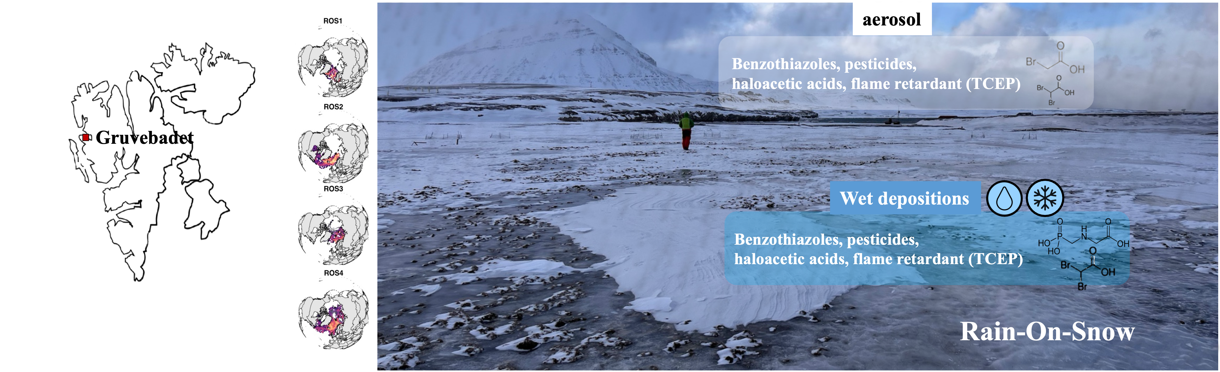
First chemical characterisation of aerosol and wet depositions during ROS events.
-
This dataset compiles the measurements of Net Ecosystem Exchange, Ecosystem Respiration and Gross Primary Productivity and associated microclimatic, vegetation and soil conditions in the High Arctic tundra in Svalbard, Measurements have been taken using the flux chamber method over a series of statistically representative points at two sites in the Bayelva Basin near the research station of Ny Alesund, Svalbard during the peak of the growing season (July-early August) starting from 2019.