Environmental manipulations in REMUS site
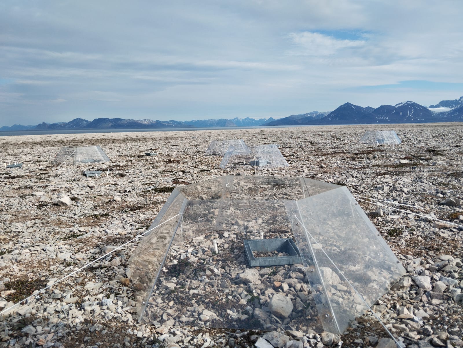
A long-term climate manipulation experiment has been ongoing since 2014 at the REMUS site (Responses of Microbes in Upper Soil Horizons to Environmental Manipulations). Twenty-four open-top chambers (OTCs) were installed to simulate warmer ground temperatures and increased precipitation. To mimic enhanced rainfall, irrigation is applied twice a year, at the end of June and August. The transparent OTCs create an average ground temperature increase of approximately 1°C in the treated plots. The site is located about 11 Km from Ny-Ålesund at Kongsfjordneset (78.96661°N 11.47576°E) on the Brøgger Peninsula. In total, 48 plots with different plant species have been selected for the study. Of these, 24 are equipped with OTCs, while the remaining 24 are irrigated, with half of the irrigated plots also containing OTCs (12 with OTCs, 12 without). The REMUS site is registered on the Research in Svalbard Portal under ID 6921. This site is part of the International Tundra Experiment (ITEX), a global research initiative aimed at understanding the responses of tundra plant species through simple manipulation and transplant experiments conducted across multiple Arctic and alpine sites.
Simple
- Date (Creation)
- 2025-01-22T16:20:00
- Identifier
- https://metadata.iadc.cnr.it/geonetwork/srv/api/records/9cfba38f-7339-4b6e-b099-b0403ec3f992
- Purpose
-
The purpose of this study is to analyze the effects of global warming trends and increasing precipitation on vegetation and soil in this area.
- Status
- On going
- Maintenance and update frequency
- Annually
-
IADC Research Activities
-
-
Ecosystem and biodiversity
-
-
GEMET - INSPIRE themes, version 1.0
-
-
Environmental monitoring facilities
-
-
GCMD - Science Keywords
-
-
TEMPERATURE TRENDS
-
REFLECTANCE
-
SOIL RESPIRATION
-
VEGETATION COVER
-
RAIN
-
-
GCMD - Instruments
-
-
SOIL TEMPERATURE PROBE
-
SOIL MOISTURE PROBE
-
IRGA
-
Temperature/Humidity Sensors
-
Spectroradiometers
-
-
GCMD - Locations
-
-
SVALBARD AND JAN MAYEN
-
- Use limitation
- Creative-Commons CC BY-NC-SA 4.0
- Spatial representation type
- Text, table
- Denominator
- 1
- Metadata language
- English
- Topic category
-
- Environment
))
- Begin date
- 2014-01-01
- End date
- 2030-12-30 Now
- Unique resource identifier
- WGS84
- Distribution format
-
-
CSV
(
1
)
-
CSV
(
1
)
- OnLine resource
- https://metadata.iadc.cnr.it/geonetwork/srv/api/records/9cfba38f-7339-4b6e-b099-b0403ec3f992 ( WWW:LINK-1.0-http--related )
- Hierarchy level
- Dataset
Domain consistency
Conformance result
- Date (Publication)
- 2010-12-08
- Explanation
-
This data set is conformant with the INSPIRE Implementing Rules for the interoperability of spatial data sets and services
- Pass
- Yes
- File identifier
- 9cfba38f-7339-4b6e-b099-b0403ec3f992 XML
- Metadata language
- English
- Character set
- UTF8
- Date stamp
- 2025-05-12T14:24:49
- Metadata standard name
-
ISO 19139
- Metadata standard version
-
1.0
Overviews
Spatial extent
Provided by