Snow height at the Gruvebadet Snow Research Site
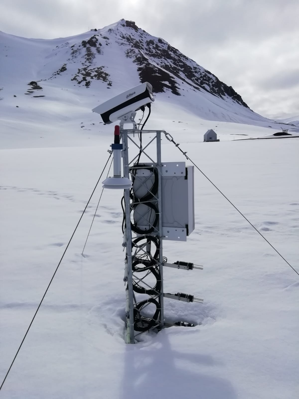
The automated nivological station was installed in November 2020 in a flat area over the tundra about 80 meters far from the Gruvebadet Atmospheric Laboratory and nearby a snow sampling site from where weekly snow samples are collected for chemical analysis. Sensors (NESA LU06) have been calibrated by their companies before installation and are connected to a datalogger for continuous acquisition. For all the parameters, data are logged with 10-minute time resolution and then averaged over 1 hour. This activity is carried out by the Aldo Pontremoli Centre part of the Joint Research Agreement ENI-CNR, in the framework of the SnowCorD project (SIOS Core Data).
Simple
- Date (Creation)
- 2021-10-01T00:00:00
- Identifier
- https://doi.org/10.5281/zenodo.13629500
- Status
- On going
- Maintenance and update frequency
- Annually
- Theme
- 
                            
- 
                            
                              
                              GEMET - INSPIRE themes, version 1.0 
- 
                            - 
                                  
                                    
                                    Land cover 
 
- 


- 
                            
                              
                              GCMD - Science Keywords 
- 
                            - 
                                  
                                    
                                    SNOW COVER 
 
- 


- 
                            
                              
                              GCMD - Instruments 
- 
                            - 
                                  
                                    
                                    ULTRASONIC DEPTH SENSOR 
 
- 


- 
                            
                              
                              GCMD - Locations 
- 
                            - 
                                  
                                    
                                    ARCTIC 
- 
                                  
                                    
                                    SVALBARD AND JAN MAYEN 
 
- 


- 
                            
                              
                              GCMD - Providers 
- 
                            - 
                                  
                                    
                                    ITALY 
 
- 


- 
                            
                              
                              IADC Research Activities 
- 
                            - 
                                  
                                    
                                    Processes at surface (Soil, snow and vegetation) 
 
- 


- Use limitation
- Creative-Commons CC BY-NC-SA 4.0
- Unique resource identifier
- IADC Italian Arctic Data Center
- Association Type
- dependency
- Initiative Type
- Project
- Spatial representation type
- Grid
- Denominator
- 1
- Metadata language
- English
- Topic category
- 
                            - Geoscientific information
 
)) 
                        - Begin date
- 2020-11-07
- End date
- 2023-12-31 Now
- Unique resource identifier
- WGS84
- Distribution format
- 
                            - 
                                
                                  
                                  NetCDF
                                
                                (
                                
                                  
                                  4
                                
                                )
                                
 
- 
                                
                                  
                                  NetCDF
                                
                                (
                                
                                  
                                  4
                                
                                )
                                
- OnLine resource
- Landing page ( WWW:LINK-1.0-http--link )
- OnLine resource
- Zenodo ( WWW:LINK-1.0-http--link )
- OnLine resource
- OPeNDAP URL ( WWW:LINK-1.0-http--opendap )
- OnLine resource
- NetCDF Direct Download ( WWW:DOWNLOAD-1.0-http--download )
- Hierarchy level
- Dataset
Domain consistency
Conformance result
- Date (Publication)
- 2010-12-08
- Explanation
- 


                                      This data set is conformant with the INSPIRE Implementing Rules for the interoperability of spatial data sets and services 
- Pass
- Yes
- Statement
- 


                              Data of snow height have sensor height correction. Data are hourly averaged. 
- File identifier
- 1e6cd3cf-de17-4f5e-a3d7-163de46da806 XML
- Metadata language
- English
- Character set
- UTF8
- Hierarchy level
- Dataset
- Date stamp
- 2025-05-12T14:24:55
- Metadata standard name
- 


                              ISO 19139 
- Metadata standard version
- 


                              1.0 
Overviews
 
                Spatial extent
)) 
                  Provided by
