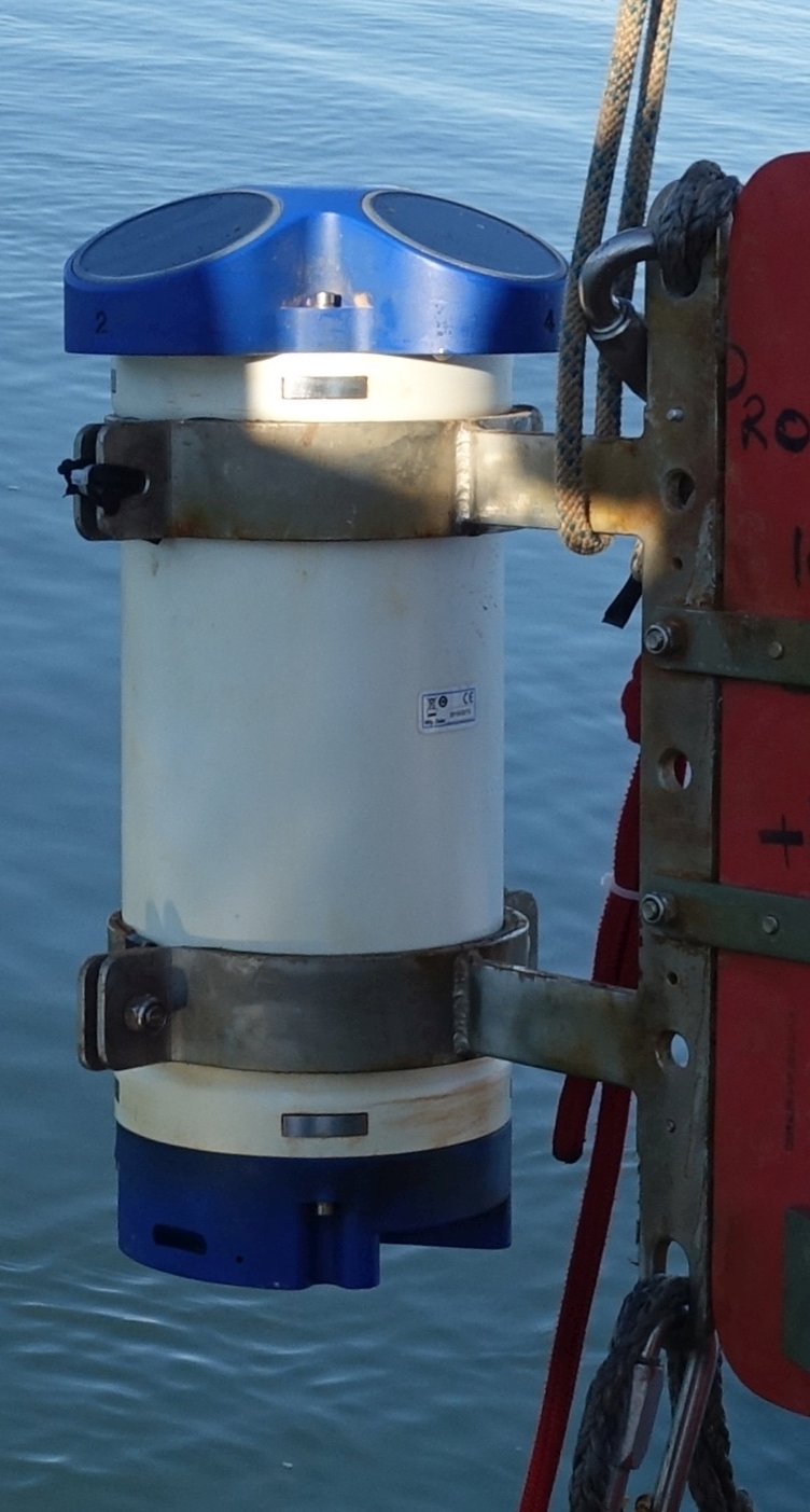
MDI Mooring ADCP data @ 95m
This dataset comprises measurements from moored Acustic Doppler Current Profiler (ADCP) installed on the Mooring Dirigibile Italia (MDI), which is managed by the Institute of Polar Sciences of the National Research Council (CNR). The mooring is active in the Kongsfjord, Svalbard Island, since 9 September 2010. This dataset is also part of the SIOS-Svalbard Integrated Arctic Earth Observing System, developed to observe the impacts of climate change, including the rapid loss of sea ice cover, the retreat of local glaciers, and the Atlantification of Arctic seas. Measured properties are: ocean currents along the water column from 95m depth until surface and sea water temperature. The acquisition of this time series data is still ongoing and will continue, bolstered by the inclusion of this infrastructure within the framework of the Italian PNRR project ITINERIS. This ensures sustained data collection and further enhances our understanding of the observed environmental changes.
Simple
- Date (Creation)
- 2025-02-03
- Date (Publication)
- 2025-02-03
- Identifier
- https://metadata.iadc.cnr.it/geonetwork/srv/api/records/143c4fe0-42b7-4acb-893a-87671f3410aa
- Status
- On going
- Maintenance and update frequency
- Annually
- Keywords
-
-
time, latitude, longitude, depth, sea_water_temperature, eastward_sea_water_velocity, northward_sea_water_velocity
-
- Use limitation
- Creative-Commons CC BY-NC-SA 4.0
- Spatial representation type
- Text, table
- Denominator
- 1
- Metadata language
- English
- Topic category
-
- Oceans
))
- Begin date
- 2015-06-23T00:00:00Z
- End date
- 2024-09-01T00:00:00Z
- Unique resource identifier
- WGS84
- Distribution format
-
-
ERDDAP
(
)
-
ERDDAP
(
)
- OnLine resource
-
Landing page
(
WWW:LINK-1.0-http--link
)
Metadata landing page
- OnLine resource
-
ERDDAP link to dataset
(
WWW:LINK-1.0-http--opendap
)
Link to ERDDAP
- OnLine resource
-
Mooring activity description
(
WWW:LINK-1.0-http--link
)
Web page of CNR ISP describing observatory activity in Svalbard region
- OnLine resource
-
Link to NetCDF files
(
WWW:DOWNLOAD-1.0-http--download
)
Download a NetCDF version
- OnLine resource
- Digital Object Identifier (DOI) ( DOI )
- Hierarchy level
- Dataset
Domain consistency
Conformance result
- Date (Publication)
- 2010-12-08
- Explanation
-
This data set is conformant with the INSPIRE Implementing Rules for the interoperability of spatial data sets and services
- Pass
- Yes
- Statement
-
moorings activities in the Kongsfjord since 2010
- File identifier
- 143c4fe0-42b7-4acb-893a-87671f3410aa XML
- Metadata language
- English
- Character set
- UTF8
- Hierarchy level
- Dataset
- Date stamp
- 2026-04-08T14:28:02
- Metadata standard name
-
ISO 19139
- Metadata standard version
-
1.0
Overviews
Spatial extent
Provided by