MAP Mooring CTD and SeaFet data at 20m
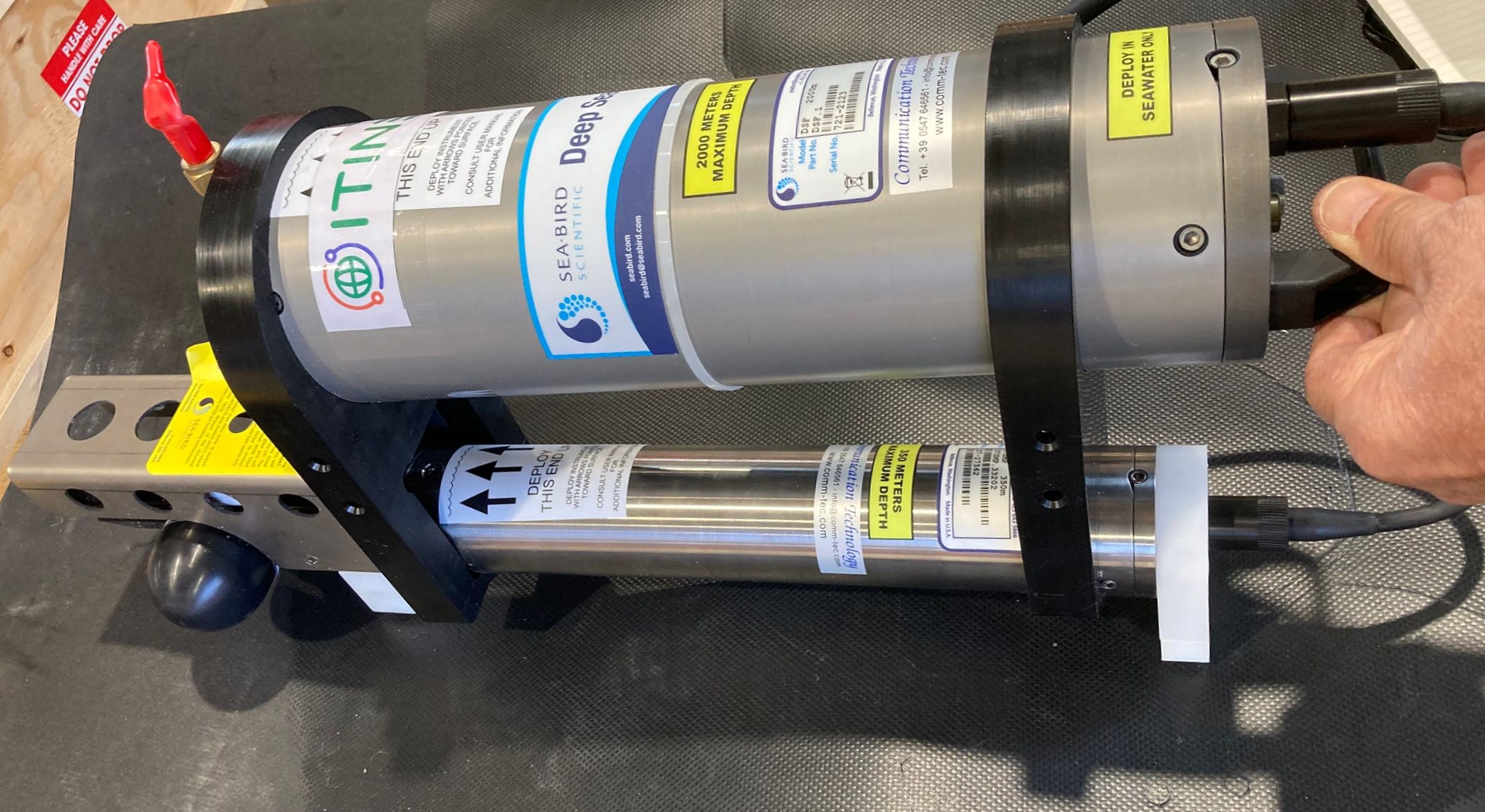
This dataset comprises measurements from moored multiparametric probe, collected by the Aldo Pontremoli Mooring (MAP), which is managed by the Institute of Polar Sciences of the National Research Council (CNR). The Aldo Pontremoli Mooring (MAP), operated by the Institute of Polar Sciences of the National Research Council (CNR), has been active in the Kongsfjord, located in the Svalbard archipelago, since September, 2020. The instrument collect a wide array of physical and biogeochemical Essential Ocean Variables, including seawater pressure, temperature, conductivity, salinity, dissolved oxygen concentration and pH. This activity is part of the Svalbard Integrated Arctic Earth Observing System (SIOS), which aims to monitor the impacts of climate change, such as the rapid loss of sea ice cover, the retreat of local glaciers, and the Atlantification of Arctic seas. Time series acquisition is ongoing and will continue, supported by funding from JRA ENI-CNR. The project's goal is to analyse the environmental feeback related to the material released into the marine environment due to permafrost melting. Reactivated permafrost can have significant consequences for both climate and the environment by contributing to the release of greenhouse gases into the atmosphere and pollutants into aquatic ecosystems
Simple
- Date (Creation)
- 2026-03-18
- Date (Publication)
- 2026-03-18
- Identifier
- https://metadata.iadc.cnr.it/geonetwork/srv/api/records/73e04bc5-e9c5-4bf6-99e4-c19df6bb5a34
- Credit
-
JRA ENI-CNR
- Status
- On going
- Maintenance and update frequency
- Annually
- Keywords
-
-
time, latitude, longitude, depth, sea_water_pressure, sea_water_temperature, sea_water_electrical_conductivity, sea_water_practical_salinity, sea_water_density, mole_concentration_of_dissolved_molecular_oxygen_in_sea_water
-
- Use limitation
- Creative-Commons CC BY-NC-SA 4.0
- Spatial representation type
- Text, table
- Denominator
- 1
- Metadata language
- English
- Topic category
-
- Oceans
))
- Begin date
- 2020-09-11
- End date
- 2030-09-01
- Unique resource identifier
- WGS84
- Distribution format
-
-
ERDDAP
()
-
ERDDAP
()
- OnLine resource
-
Landing page
(
WWW:LINK-1.0-http--link
)
Metadata landing page
- OnLine resource
-
ERDDAP link to dataset
(
WWW:LINK-1.0-http--opendap
)
Link to ERDDAP
- OnLine resource
-
LINK TO NETCDF FILES
(
WWW:DOWNLOAD-1.0-http--download
)
Link to NetCDF files of CTD and SeaFET data at 20m depth on MAP mooring
- OnLine resource
-
Mooring activity description
(
WWW:LINK-1.0-http--link
)
Web page of CNR ISP describing observatory activity in Svalbard region
- OnLine resource
- Digital Object Identifier (DOI) ( DOI )
- Hierarchy level
- Dataset
Domain consistency
Conformance result
- Date (Publication)
- 2010-12-08
- Explanation
-
This data set is conformant with the INSPIRE Implementing Rules for the interoperability of spatial data sets and services
- Pass
- Yes
- Statement
-
Time series acquisition of biogeochemical parameters along the water column along the mooring MAP
- File identifier
- 73e04bc5-e9c5-4bf6-99e4-c19df6bb5a34 XML
- Metadata language
- English
- Character set
- UTF8
- Hierarchy level
- Dataset
- Date stamp
- 2026-04-28T14:31:31
- Metadata standard name
-
ISO 19139
- Metadata standard version
-
1.0
Overviews
Spatial extent
Provided by