CO2 fluxes and ancillary meteo-climatic variables (CZO@Bayelva)
Observing Earth critical zone processes in the Bayelva basin (CZO@Bayelva).
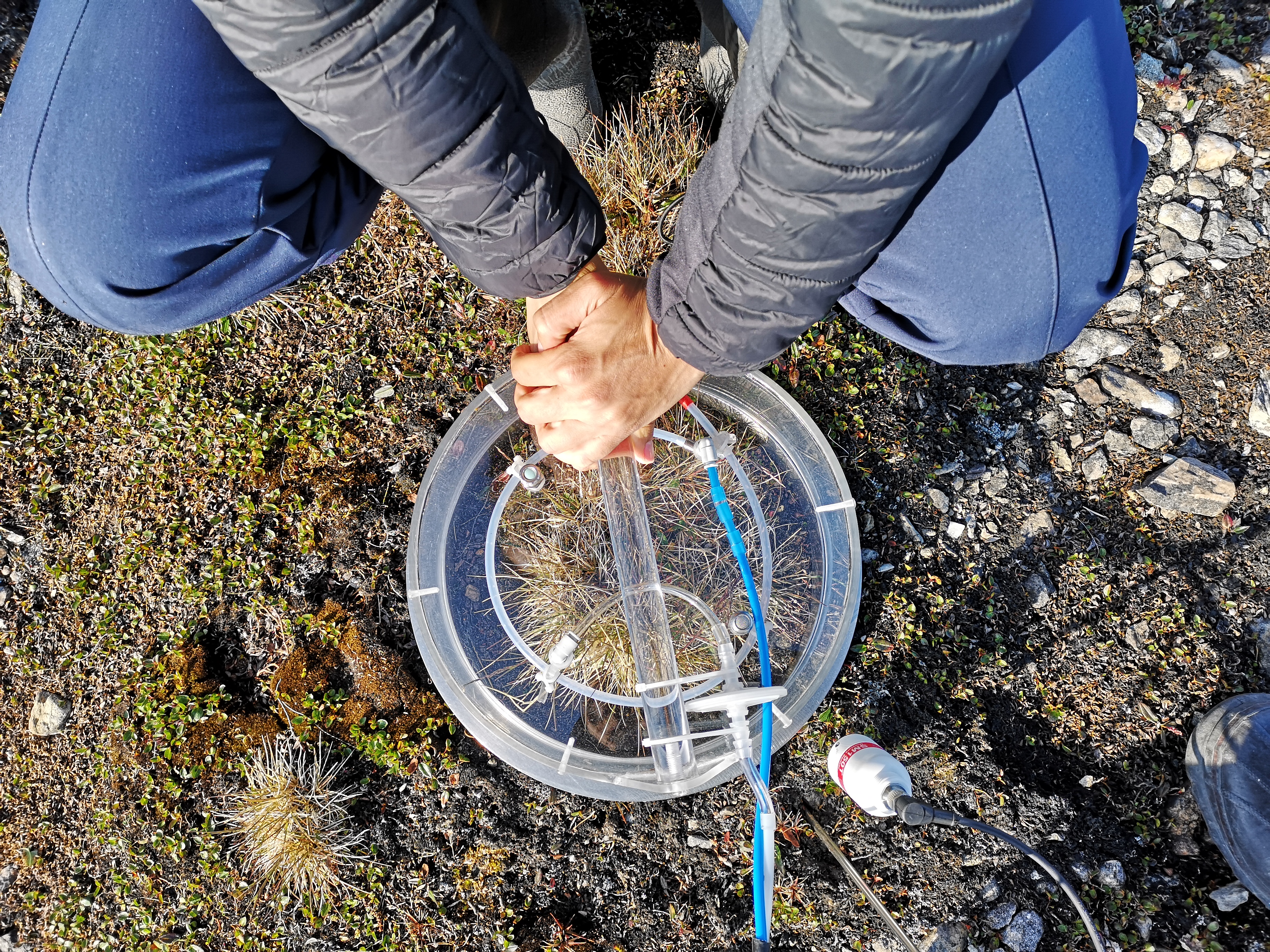
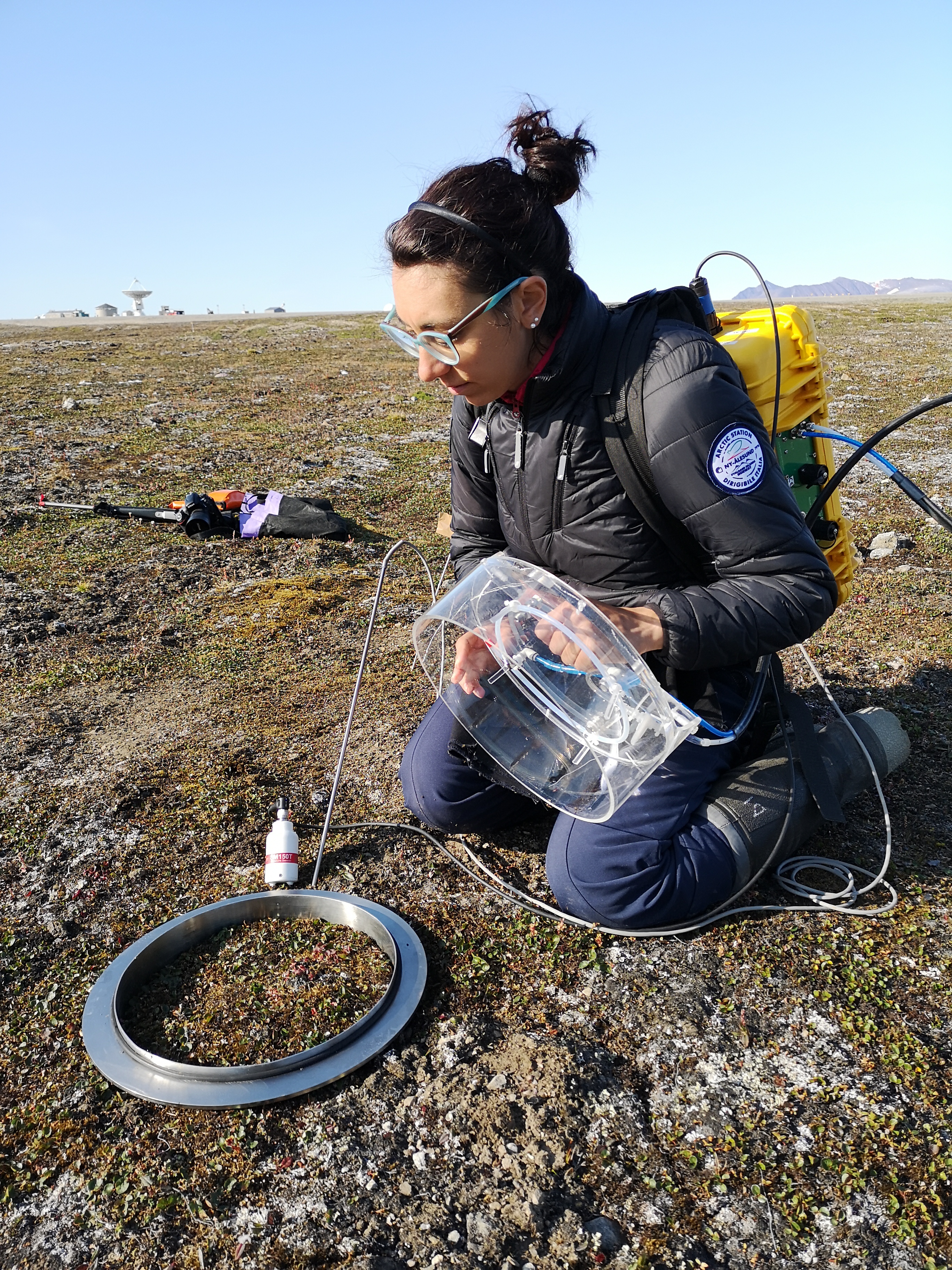
Data represents the average values and the corresponding standard deviation of Net Ecosystem Exchange (NEE), Ecosystem Respiration (ER) and Gross Primary Productivity (GPP) obtained from two different sites in the tundra of the Bayelva river basin: One site (named CZ) is located in the vicinity of the Climate Change Tower. The other one (named "Airport") is in the vicinity of the Ny Alesund Airport. Each average value is obtained as a mean over a set of around 20 point measures for each plot and each sampling date. Flux data are complemented by measurements of soil temperature, soil volumetric water content, air temperature and relative humidity, and solar irradiance. CO2 fluxes are measured using a flux chamber and a LI-COR IRGA by means of the Dynamic Flux Chamber method.
Simple
- Date (Creation)
- 2026-06-29T00:00:00
- Date (Publication)
- 2026-06-29T00:10:00
- Identifier
- https://metadata.iadc.cnr.it/geonetwork/srv/api/records/4aecb836-4196-4c0d-abeb-4b44bfdd7309
- Status
- On going
- Maintenance and update frequency
- As needed
- Theme
-
-
critical zone, CO2 fluxes, time, gross_primary_productivity_of_biomass_expressed_as_carbon, downwelling_shortwave_flux_in_air, soil_temperature, soil_temperature, longitude, latitude
-
-
GEMET - INSPIRE themes, version 1.0
-
-
Environmental monitoring facilities
-
Habitats and biotopes
-
-
GCMD - Science Keywords
-
-
SOIL TEMPERATURE
-
BIOGEOCHEMICAL PROCESSES
-
SOIL MOISTURE/WATER CONTENT
-
ALPINE/TUNDRA
-
CARBON
-
-
GCMD - Instruments
-
-
Spectrometers
-
-
GCMD - Locations
-
-
ARCTIC
-
SVALBARD AND JAN MAYEN
-
-
GCMD - Providers
-
-
ITALY
-
-
IADC Research Activities
-
-
Ecosystem and biodiversity
-
-
IADC Research Activities 2
-
-
Terrestrial ecosystem and biodiversity
-
- Use limitation
- Creative-Commons CC BY-NC-SA 4.0
- Unique resource identifier
- IADC Italian Arctic Data Center
- Association Type
- dependency
- Initiative Type
- Project
- Spatial representation type
- Text, table
- Denominator
- 1
- Metadata language
- English
- Topic category
-
- Environment
- Geoscientific information
))
- Begin date
- 2019-07-24
- End date
- 2025-08-03 Now
- Unique resource identifier
- WGS84
- Distribution format
-
-
CSV
(
1
)
-
CSV
(
1
)
- OnLine resource
- Landing page ( WWW:LINK-1.0-http--link )
- OnLine resource
- RIS Project ( WWW:LINK-1.0-http--link )
- OnLine resource
-
OPeNDAP URL
(
WWW:LINK-1.0-http--opendap
)
Link to OPeNDAP URL
- OnLine resource
-
Direct download
(
WWW:DOWNLOAD-1.0-http--download
)
Download a NetCDF version
- OnLine resource
-
Direct download
(
WWW:DOWNLOAD-1.0-http--download
)
Download a CSV version
- OnLine resource
- Digital Object Identifier (DOI) ( DOI )
- Hierarchy level
- Dataset
Domain consistency
Conformance result
- Date (Publication)
- 2010-12-08
- Explanation
-
This data set is conformant with the INSPIRE Implementing Rules for the interoperability of spatial data sets and services
- Pass
- Yes
- Statement
-
Study the dynamics of CO2 exchanges between soil, vegetation and atmosphere in the "critical zone" tundra of the area formerly occupied by the retreating Vestre and Austre Brøggerbreen glaciers at Svalbard, in the Bayelva basin (Svalbard, NO).
Point measurements of CO2 fluxes were performed over two different sites in the Bayelva Basin by using a portable Infrared Gas Analyser (IRGA) equipped with a transparent flux chamber (model LiCOR 850 LI-COR Environmental, USA); Net Ecosystem Exchange (NEE) and Ecosystem Respiration (Reco) were sued to calculate the Gross Primary Productivity is calculated. Meteo-climatic variables, including solar irradiance, and soil temperature and water content were concurrently measured. Green Fractional cover was calculated form RGB pictures.
- File identifier
- 4aecb836-4196-4c0d-abeb-4b44bfdd7309 XML
- Metadata language
- English
- Character set
- UTF8
- Hierarchy level
- Dataset
- Date stamp
- 2026-07-06T09:24:48
- Metadata standard name
-
ISO 19139
- Metadata standard version
-
1.0
Overviews

Spatial extent
Provided by